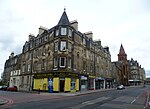
Westfield, Edinburgh
Areas of EdinburghEdinburgh geography stubsUse British English from February 2017
Westfield is a neighbourhood of Edinburgh, the capital of Scotland. It is north of the A71 road, between the Balgreen, Gorgie and Slateford areas.
Excerpt from the Wikipedia article Westfield, Edinburgh (License: CC BY-SA 3.0, Authors).Westfield, Edinburgh
Westfield Road, City of Edinburgh Gorgie/Dalry
Geographical coordinates (GPS) Address Nearby Places Show on map
Geographical coordinates (GPS)
| Latitude | Longitude |
|---|---|
| N 55.938055555556 ° | E -3.24 ° |
Address
Sainsbury's
Westfield Road 39
EH11 2QW City of Edinburgh, Gorgie/Dalry
Scotland, United Kingdom
Open on Google Maps


