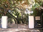
West Hills, Los Angeles

West Hills is a suburban/residential community in the western San Fernando Valley region of the City of Los Angeles, California. The percentage of residents aged 35 and older is among the highest in Los Angeles County.The neighborhood was formerly the home of many Native American tribes, and during the early Spanish and Mexican era was part of the Mission San Fernando Rey de España. In the American era, West Hills was part of Owensmouth, which was renamed Canoga Park in 1930. West Hills was established in western Canoga Park and retained its present name in 1987. Historic landmarks and many city parks are to be found within the community, as are commercial districts, a business district, and religious establishments. Two private high schools are among the 13 schools within West Hills.
Excerpt from the Wikipedia article West Hills, Los Angeles (License: CC BY-SA 3.0, Authors, Images).West Hills, Los Angeles
Cohasset Street, Los Angeles West Hills Neighborhood Council District
Geographical coordinates (GPS) Address Nearby Places Show on map
Geographical coordinates (GPS)
| Latitude | Longitude |
|---|---|
| N 34.20639 ° | E -118.638959 ° |
Address
Cohasset Street 23399
91304 Los Angeles, West Hills Neighborhood Council District
California, United States
Open on Google Maps


