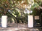
Rancho El Escorpión
1845 establishments in Alta California19th century in Los AngelesCalifornia ranchosCanoga Park, Los AngelesHistoric American Buildings Survey in California ... and 7 more
History of Los AngelesHistory of the San Fernando ValleyRanchos of Los Angeles County, CaliforniaSimi HillsTongvaTongva populated placesWest Hills, Los Angeles
Rancho El Escorpión was a 1,110-acre (4.5 km2) Mexican land grant in present day Los Angeles County, California given in 1845 by Governor Pío Pico to three Chumash Native Americans - Odón Chijulla, Urbano, and Mañuel. The half league square shaped Rancho El Escorpión was located at the west end of the San Fernando Valley on Bell Creek against the Simi Hills, and encompassed parts of present day West Hills (previously Owensmouth and Canoga Park) and Woodland Hills.
Excerpt from the Wikipedia article Rancho El Escorpión (License: CC BY-SA 3.0, Authors).Rancho El Escorpión
Rock Ridge Terrace, Los Angeles West Hills Neighborhood Council District
Geographical coordinates (GPS) Address Nearby Places Show on map
Geographical coordinates (GPS)
| Latitude | Longitude |
|---|---|
| N 34.2 ° | E -118.65 ° |
Address
Rock Ridge Terrace 7132
91307 Los Angeles, West Hills Neighborhood Council District
California, United States
Open on Google Maps


