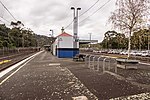
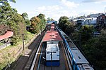
Upwey, Victoria

Upwey is a suburb of Melbourne, Victoria, Australia, 33 kilometres (21 mi) east from Melbourne's central business district, located within the City of Knox and the Shire of Yarra Ranges local government areas. Upwey recorded a population of 6,818 at the 2021 census.Upwey South is a colloquial term for the area directly south of the township, but is not an official suburb.Upwey is bounded by: North by the suburb of Ferny Creek (Janesleigh Road, Hughes Street) East by the suburb of Tecoma (Belgrave-Ferny Creek Road, Terrys Avenue) South by the suburb of Lysterfield (Glenfern Road, McNicol Road and Monbulk Creek) West by the suburb of Upper Ferntree Gully (New Road, Ferndale Road, Fern Road, Victoria Ridge, Forest View Lane, Wynette Avenue, Old Belgrave Road, Royal Street, Burwood Highway and Mount Dandenong Tourist Road)Burwood Highway and Glenfern Road are the two main roads that run through Upwey which are connected by Morris Road. These three roads form the main routes around the suburb. Glenfern Road runs along the ridge of the hill providing views across the city and the Lysterfield Valley.
Excerpt from the Wikipedia article Upwey, Victoria (License: CC BY-SA 3.0, Authors, Images).Upwey, Victoria
Main Street, Melbourne Upwey
Geographical coordinates (GPS) Address Phone number Website Nearby Places Show on map
Geographical coordinates (GPS)
| Latitude | Longitude |
|---|---|
| N -37.903 ° | E 145.33 ° |
Address
Upwey Dental
Main Street Shop 3 9-21
3158 Melbourne, Upwey
Victoria, Australia
Open on Google Maps


