Hochrhönring
German tourist routesRhön MountainsRoads in Hesse

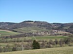
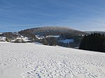
The Hochrhönring (also Hochrhön-Ring) is a 42-kilometre-long holiday route in the Hessian Rhön in Germany.The route, which opened in 1970, runs in a circle roughly east of Gersfeld past the Feldberg (815 m), the Wasserkuppe (950 m), Abtsroda, Dietges, the Milseburg (835 m), Kleinsassen, Wolferts, Poppenhausen and Gackenhof and back to Gersfeld.The route is signposted with signs that display the black lettering Hochrhönring on a white background, usually with a thistle on a dark green background (which is often rather faded). The route is popular with motorcyclists and is sometimes nicknamed "the Route 66 of the Rhön".
Excerpt from the Wikipedia article Hochrhönring (License: CC BY-SA 3.0, Authors, Images).Hochrhönring
Amelungstraße, Gersfeld (Rhön)
Geographical coordinates (GPS) Address Nearby Places Show on map
Geographical coordinates (GPS)
| Latitude | Longitude |
|---|---|
| N 50.45 ° | E 9.9202777777778 ° |
Address
Amelungstraße 5
36129 Gersfeld (Rhön)
Hesse, Germany
Open on Google Maps


