Wasserkuppen Rhön
Fulda (district)Mountain ranges of BavariaMountain ranges of HesseNatural regions of the East Hesse HighlandsRhön-Grabfeld ... and 1 more
Rhön Mountains

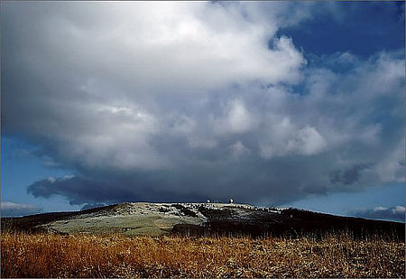
The Wasserkuppen Rhön or Wasserkuppenrhön, named after its highest peak, also the highest summit in the entire Rhön Mountains, the Wasserkuppe (950 m above sea level (NHN)), is an exposed highland ridge and natural region in the Hessian county of Fulda and Bavarian county of Rhön-Grabfeld. Together with the Long Rhön and its eastern flank it forms the Central Rhön. The Red Moor lies within this natural region.
Excerpt from the Wikipedia article Wasserkuppen Rhön (License: CC BY-SA 3.0, Authors, Images).Wasserkuppen Rhön
Wasserkuppe, Gersfeld (Rhön)
Geographical coordinates (GPS) Address Nearby Places Show on map
Geographical coordinates (GPS)
| Latitude | Longitude |
|---|---|
| N 50.49806 ° | E 9.93778 ° |
Address
Wasserkuppe
36129 Gersfeld (Rhön)
Hesse, Germany
Open on Google Maps


