place

Ottawa—Vanier (provincial electoral district)

Provincial electoral districts of Ottawa
Ottawa ottawavanier
Ottawa ottawavanier

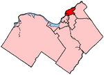
Ottawa—Vanier (formerly known as Ottawa East) is a provincial electoral district in Ottawa, Ontario, Canada, that has been represented in the Legislative Assembly of Ontario since 1908. It is located in the east end of Ottawa. The riding, with a large Franco-Ontarian population in Vanier, Overbrook, Lower Town, and in adjoining neighbourhoods, has been one of the most solidly Liberal in the country in recent years, having elected Liberals both federally and provincially in every election since 1971. A sizable minority of the riding is in the former city of Vanier, which was merged with Ottawa in 2000. Vanier has long been home to much of Ottawa's francophone population, but between 1992 and 2001, the size of this linguistic group has fallen by almost 50%. Since 2003, the population of the entire riding has fallen by almost 10% at a time when the rest of the nation's capital increased by approximately 5.2%. The riding now has the second oldest population in Ottawa. In many ways the riding which used to be known as a French riding with an English face has become a largely English-speaking riding (65%) with a French face. The riding also contains the wealthiest part of Ottawa, Rockcliffe Park, which gives some support to the Progressive Conservatives, but also to the Liberals. The neighbourhoods with higher proportions of anglophone residents, including Sandy Hill and New Edinburgh also tend to vote Liberal, but with significant support for the Ontario New Democratic Party. The riding is characterized by below average voter turn-out and an annual loss of approximately 1% in voter support for the provincial Liberals since 1987 thereby reducing their support from approximately 74% to 50% (1987–2007).

Excerpt from the Wikipedia article Ottawa—Vanier (provincial electoral district) (License: CC BY-SA 3.0, Authors, Images).

Ottawa—Vanier (provincial electoral district)
Belisle Street, (Old) Ottawa Vanier (Rideau-Vanier)

Geographical coordinates (GPS) Address Nearby Places
placeShow on map

Wikipedia: Ottawa—Vanier (provincial electoral district)Continue reading on Wikipedia

Geographical coordinates (GPS)

Latitude Longitude
N 45.433333333333 ° E -75.65 °
placeShow on map

Address

Belisle Street 775
K1L 6N5 (Old) Ottawa, Vanier (Rideau-Vanier)
Ontario, Canada
mapOpen on Google Maps

Ottawa ottawavanier
Ottawa ottawavanier
Share experience

Nearby Places

Ottawa Technical Secondary School

The Ottawa Technical Secondary School (name changed as of May 1, 2010) is an Ottawa-Carleton District School Board high school in Ottawa, Ontario, Canada. It specializes in technology, trades, design and engineering education. It is located on Donald Street, Ottawa Ontario Canada (Rideau/ Rockcliffe ward 13)-2023 serving students from the entire east side of the Rideau River. Until 2001, it was known as McArthur High School . From 2001 until 2010 it was known as Ottawa Technical Learning Centre. The school opened in 1973 and was one of several vocational schools operated by the Ottawa Board of Education. In 2010, the name was changed to Ottawa Technical Secondary School. The school continues to serve a diverse population of students and is the home of several autistic spectrum disorder (ASDP), general learning progam (GLP), physical support program (PSP) and a technology, trades, design and engieering classes. OTSS provides students with educational opportunities that lead to the world of work, community college and univsersity pathways. The school offers a wide array of programs from the culinary arts, communication techology, construction technology, design technology, cosmotology, transporation technology, and manufacturing. Students also have a variety of oppportunities to engage in OYAP, co-op, and dual credit programs at a local college. Higher grades, students spend much of their time in co-operative education programs. See also List of high schools in Ontario

Overbrook, Ottawa

Overbrook is an urban neighbourhood situated in Rideau-Rockcliffe Ward, in the east end of Ottawa, Ontario, Canada. It is located across the Rideau River from the neighbourhood of Sandy Hill and is just to the south of Vanier. To the east of Overbrook is the former City of Gloucester. It was constituted as a police village in 1922 and was annexed by the City of Ottawa in 1950.Overbrook covers an area of 3.04 square kilometres and has a population density of 3,174 people per square kilometre (2011 Census). Overbrook's main street is Queen Mary Street, which runs from North River Road to St. Laurent Boulevard. Although predominantly a residential neighbourhood at Overbrook's south end is Coventry Road where commercial and office buildings are found along with a major shopping centre (St. Laurent Centre) at the intersection with St. Laurent Boulevard. The neighborhood of Overbrook is bounded on the north by the former City of Vanier, on the west by the Rideau River, on the south by provincial Highway 417 (the Queensway) and on the east by St. Laurent Boulevard. The eastern part of the community overlaps with the Castle Heights neighbourhood. The neighbourhood was in the fifth of 5 socio-economic levels, with 1 representing the most advantaged neighbourhood and 5 the least advantaged neighbourhood. A minority (36%) of the residents owned their homes, while 64% rented. Housing is unaffordable for many residents in West Overbrook; 32% spend more than 30% of their income on shelter. Eight percent of the dwellings were reported to be in need of major repairs (higher than city average). The number of persons per room (0.46), a measure of crowding, was also higher than the city average. In 2005, the property crime rate of 66.4 per thousand people was higher than the city average of 57 per thousand people. Personal crime rates were also higher than the city average of 24 per thousand people, at 52.8 per thousand people. 2016 Census of Canada data indicate that knowledge of official languages has 47% of the population speaking English only and 47% speaking both English and French and the remaining 6% French only or neither English or French. Overbrook is relatively close to downtown Ottawa and is seeing increased residential infill redevelopment. This is being aided by recent transportation connectivity improvements such as the 2015 opening of the Adàwe Crossing (pedestrian and cyclist bridge across the Rideau River) and the ability to use the Max Keeping Bridge (pedestrian and cyclist bridge over Highway 417) to access both Via Rail Ottawa station and the newer Tremblay station, which opened in 2019 on the O-Train Confederation Line.

St. Laurent Centre
St. Laurent Centre

St. Laurent Centre (French: Centre St-Laurent) is a shopping mall located in Ottawa, Ontario, Canada. It is owned and operated by Morguard REIT. The shopping mall is located just north of Highway 417 at the corner of St. Laurent Boulevard and Coventry Road. The mall opened in October 1967 housing 50 retailers with Simpson-Sears (later Sears), Freimans and Dominion as original anchors. Sears was the last original anchor to leave the mall, closing on January 8, 2018 due to bankruptcy of the chain. Hudsons Bay is currently the mall's oldest anchor tenant, having purchased Freimans in December 1971 and rebranding the store to The Bay in June 1973. On March 13, 1991, The Bay moved to its current two level location as part of a mall expansion. It is adjacent to the former space of The Bay and 50% larger. The former store was converted to a food court, office space, and other retailers. The mall is also anchored by Toys "R" Us.On the afternoon of September 16, 2022, there was a physical altercation involving multiple people in their late teens and early 20s. The event took place just outside the mall's Dollarama. Marcus Maloney (19) was stabbed, and later pronounced dead in hospital. Mohammed Osman (18) was later charged with second degree murder, along with two counts of aggravated assault and one count of breaching release conditions after being apprehended by Ottawa Police overnight.St. Laurent Centre is the third largest mall in terms of total space in the National Capital Region behind Rideau Centre and Bayshore Shopping Centre with 880,736 sq ft of leasable area, although a large portion of the mall's gross leasable area is utilized by non-retail tenants. It is currently the 27th largest mall in Canada. The mall's owner, Morguard, has applied to the City of Ottawa for land-use planning approvals to permit an expansion of the mall, bringing the overall size to 121,000 square metres (1,300,000 sq ft). If approved, the expansion would make St. Laurent Centre the 10th largest mall in Canada. The expansion plan is currently on hold indefinitely.The mall has a total of 195 stores and services on three levels. The centre also hosts a large amount of non-retail tenants including office space, a dental clinic, a gym (GoodLife Fitness), a second-run theatre and a career college (Willis College). OC Transpo's St-Laurent station is connected to the mall. It has three levels: the underground Confederation Line platforms, the intermediate mezzanine which connects to the shopping centre, and a local bus platform on the upper level where OC Transpo routes 5, 7, 14 and 18 all end or start their trips. The tunnel-level is accessible via escalators and elevators from the mall. OC Transpo also has a client service kiosk at the station. The original Transitway station opened in 1987 after the mall had an expansion of about 80 stores. On June 28, 2015, the underground Transitway platforms closed for the construction of the Confederation Line which began service on September 14, 2019. Rider Express offers a Toronto-Kingston-Ottawa service departing from Entrance 3 of St. Laurent Centre. Megabus intercity buses bound for Kingston, Scarborough, and Toronto depart from Stop C at St-Laurent Station