Vanier, Ontario

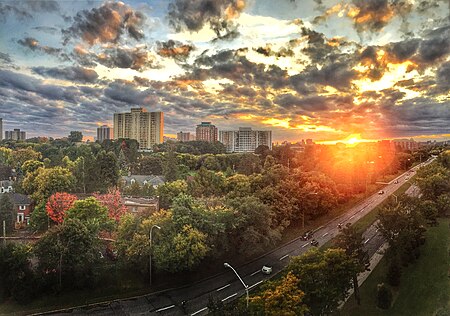
Vanier, formerly Eastview, is a neighbourhood in the Rideau-Vanier Ward of the east end of Ottawa, Ontario, Canada. Historically francophone and working class, the neighbourhood was a separate city until being amalgamated into Ottawa in 2001. It no longer has a majority francophone population. By 2012 its francophone population had shrunk to less than 40% from 63% in the early 1980s. The neighbourhood is located on the east bank of the Rideau River, across from the neighbourhoods of Lowertown and Sandy Hill, and just south of Rockcliffe Park, New Edinburgh, Lindenlea, and Manor Park. To the east of Vanier are the suburbs of Gloucester. Vanier has a relatively small area with a high population density.
Excerpt from the Wikipedia article Vanier, Ontario (License: CC BY-SA 3.0, Authors, Images).Vanier, Ontario
Marier Avenue, Ottawa Vanier (Rideau-Vanier)
Geographical coordinates (GPS) Address Nearby Places Show on map
Geographical coordinates (GPS)
| Latitude | Longitude |
|---|---|
| N 45.439722222222 ° | E -75.665 ° |
Address
Partage Vanier Food Bank
Marier Avenue 161
K1L 7R6 Ottawa, Vanier (Rideau-Vanier)
Ontario, Canada
Open on Google Maps


