place

Forbes, Ottawa

Neighbourhoods in OttawaOttawa stubsUse Canadian English from January 2023
St Louis Marie de Montfort, Ottawa

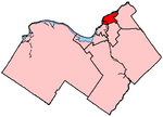
Forbes is a neighbourhood in Rideau-Rockcliffe Ward in the east end of Ottawa, Ontario, Canada.It is defined by the city as being bounded on the North by Montreal Road, on the east by the Aviation Parkway, on the west and south by the former municipal boundary of the city, and on the southwest by McArthur Avenue. However, the area west of St. Laurent Boulevard is part of the Overbrook Community Association, and most maps show Forbes as being east of St. Laurent. The total population of the neighbourhood (east of St. Laurent) was 2,918 according to the Canada 2016 Census.Much of the neighbourhood was built in the 1950s and 1960s.The neighbourhood is home to Helen Redpath Thompson Park, Trojan Park and Forbes Park as well as the former Rideau High School.

Excerpt from the Wikipedia article Forbes, Ottawa (License: CC BY-SA 3.0, Authors, Images).

Forbes, Ottawa
Borthwick Avenue, Ottawa

Geographical coordinates (GPS) Address Nearby Places
placeShow on map

Wikipedia: Forbes, OttawaContinue reading on Wikipedia

Geographical coordinates (GPS)

Latitude Longitude
N 45.4375 ° E -75.638888888889 °
placeShow on map

Address

Borthwick Avenue 758
K1K 4S5 Ottawa (Rideau-Rockcliffe)
Ontario, Canada
mapOpen on Google Maps

St Louis Marie de Montfort, Ottawa
Share experience

Nearby Places

Montfort Hospital
Montfort Hospital

Montfort Hospital (French: Hôpital Montfort), commonly shortened to Montfort in both English and French, is a teaching hospital affiliated with the University of Ottawa. It offers short-term primary and secondary health care, offering service in both the French and English language. The hospital serves over 1.2 million residents of Eastern Ontario, and the Gatineau region of Quebec. Montfort is the only hospital in Ottawa that administers in French and the only Francophone academic healthcare institution west of the province of Quebec.In 2014 and 2018, Montfort was accredited by Accreditation Canada. It was recognized as a "Best Practice Spotlight Organization" from the Registered Nurses’ Association of Ontario (RNAO). In June 2013, the hospital was designated a Group A teaching hospital.Montfort trains Francophone healthcare professionals with the help of the hospital's knowledge institute, the Institut du Savoir Montfort (ISM), and in collaboration with its main partners, the University of Ottawa and La Cité college as well as other post-secondary education programs. In 2015, it was ranked as Canada's top 40 research hospitals owing to the activities of ISM-Research. The executive management team is led by chief executive officer Dr. Bernard Leduc. The medical team reports to Chief of Staff Dr. Thierry Daboval. The chair of the board of trustees is Carl Nappert.Montfort opened in 1953. It was secularized in 1970. It expanded in 1992, and again in 2010.

Ottawa Technical Secondary School

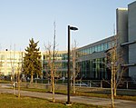
The Ottawa Technical Secondary School (name changed as of May 1, 2010) is an Ottawa-Carleton District School Board high school in Ottawa, Ontario, Canada. It specializes in technology, trades, design and engineering education. It is located on Donald Street, Ottawa Ontario Canada (Rideau/ Rockcliffe ward 13)-2023 serving students from the entire east side of the Rideau River. Until 2001, it was known as McArthur High School . From 2001 until 2010 it was known as Ottawa Technical Learning Centre. The school opened in 1973 and was one of several vocational schools operated by the Ottawa Board of Education. In 2010, the name was changed to Ottawa Technical Secondary School. The school continues to serve a diverse population of students and is the home of several autistic spectrum disorder (ASDP), general learning progam (GLP), physical support program (PSP) and a technology, trades, design and engieering classes. OTSS provides students with educational opportunities that lead to the world of work, community college and univsersity pathways. The school offers a wide array of programs from the culinary arts, communication techology, construction technology, design technology, cosmotology, transporation technology, and manufacturing. Students also have a variety of oppportunities to engage in OYAP, co-op, and dual credit programs at a local college. Higher grades, students spend much of their time in co-operative education programs. See also List of high schools in Ontario

Ottawa—Vanier (provincial electoral district)

Ottawa—Vanier (formerly known as Ottawa East) is a provincial electoral district in Ottawa, Ontario, Canada, that has been represented in the Legislative Assembly of Ontario since 1908. It is located in the east end of Ottawa. The riding, with a large Franco-Ontarian population in Vanier, Overbrook, Lower Town, and in adjoining neighbourhoods, has been one of the most solidly Liberal in the country in recent years, having elected Liberals both federally and provincially in every election since 1971. A sizable minority of the riding is in the former city of Vanier, which was merged with Ottawa in 2000. Vanier has long been home to much of Ottawa's francophone population, but between 1992 and 2001, the size of this linguistic group has fallen by almost 50%. Since 2003, the population of the entire riding has fallen by almost 10% at a time when the rest of the nation's capital increased by approximately 5.2%. The riding now has the second oldest population in Ottawa. In many ways the riding which used to be known as a French riding with an English face has become a largely English-speaking riding (65%) with a French face. The riding also contains the wealthiest part of Ottawa, Rockcliffe Park, which gives some support to the Progressive Conservatives, but also to the Liberals. The neighbourhoods with higher proportions of anglophone residents, including Sandy Hill and New Edinburgh also tend to vote Liberal, but with significant support for the Ontario New Democratic Party. The riding is characterized by below average voter turn-out and an annual loss of approximately 1% in voter support for the provincial Liberals since 1987 thereby reducing their support from approximately 74% to 50% (1987–2007).

Carson Meadows
Carson Meadows

Carson Meadows is a neighbourhood in Rideau-Rockcliffe Ward in the east end of Ottawa, Ontario, Canada. It is roughly located south of Montreal Road and north of Collège La Cité, west of the National Research Council National Science Library site, and generally east of Carsons Road. This area has an approximate population of 3300 (2016 Census). The neighbourhood has a plurality Francophone population. The five dissemination areas that cover most of the area together are 40% Francophone and 39% Anglophone. Creole languages are the third largest linguistic group at 6%.The area was once known as Rockville, with a post office opening up in 1871. The area went through a number of names such as Robillard and Rock Village, with the post office being renamed to Quarries in 1903, and closing in 1961. The area was home to a number of quarries which provided stones for Parliament Buildings among other places in the Ottawa area. The quarries would later be renamed. The "Quarries" name still appears on some maps of the area, as it is recorded under that name by the Geographical Names Data Base.A subdivision was built in the area in the early 1960s by Mastercraft Homes, and sold by Guaranty Trust Company of Canada. This subdivision was originally called Carson's Meadows. As of 1965, the neighbourhood consisted of a few houses on Hochelaga Street, the Carson Hill Apartments on Carsons Road, and a subdivision between Bermuda Avenue and Charleswood Avenue. Over the next decade, the Summerhill subdivision was built on Bathgate Dr, as well as the Hochelaga Rental Homes, the CrossWinds apartments, Las Brisas apartments and the Carson's Community Ottawa Housing project. By 1991, the Bathgate Court Ottawa Housing project and the Concorde Apartments were built. Over the next decade, the Desloges Cooperative Housing was built.