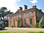
Kerry, Powys
CommotesCommunities in PowysDolforgan EstateVillages in Powys
Kerry (Welsh: Ceri) is a village and geographically large community in Montgomeryshire, Powys, Wales. The village lies on the A489 road 2.8 miles (4.5 km) southeast of Newtown and possesses two pubs — the Herbert Arms and the Kerry Lamb — a village hall, a bowling green, a post office, a primary school and a hairdresser. Kerry also has a parish church of Norman origins dedicated to St. Michael and All Angels, as well as a baptist church. It gives its name to the Kerry Hill breed of sheep.
Excerpt from the Wikipedia article Kerry, Powys (License: CC BY-SA 3.0, Authors).Kerry, Powys
A489,
Geographical coordinates (GPS) Address Nearby Places Show on map
Geographical coordinates (GPS)
| Latitude | Longitude |
|---|---|
| N 52.5012 ° | E -3.25803 ° |
Address
A489
SY16 4NR , Kerry
Wales, United Kingdom
Open on Google Maps


