place

Hinton Hill, Wellow

English Site of Special Scientific Interest stubsSites of Special Scientific Interest in AvonSites of Special Scientific Interest notified in 1996Somerset geography stubs
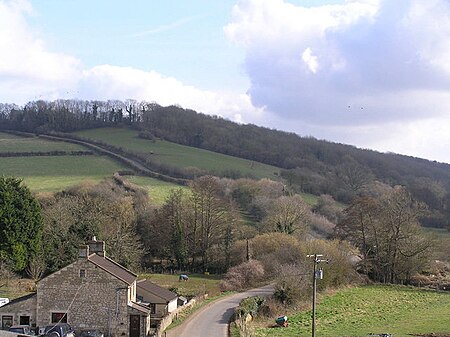
Hinton Hill Wellow
Hinton Hill Wellow

Hinton Hill, Wellow (grid reference ST757582) is a 0.25 hectare geological Site of Special Scientific Interest (SSSI) near the village of Wellow in Somerset, notified in 1996. The site is of importance to studies of the stratigraphy of the Middle Jurassic of the Bath district, and the British Bathonian as a whole.Hinton Hill, Wellow is governed by a local planning authority named Bath and North East Somerset and is named as a Site of Special Scientific Interest.

Excerpt from the Wikipedia article Hinton Hill, Wellow (License: CC BY-SA 3.0, Authors, Images).

Hinton Hill, Wellow
Hinton Hill,

Geographical coordinates (GPS) Address Nearby Places
placeShow on map

Wikipedia: Hinton Hill, WellowContinue reading on Wikipedia

Geographical coordinates (GPS)

Latitude Longitude
N 51.32238 ° E -2.3501 °
placeShow on map

Address

Hinton Hill

Hinton Hill
BA2 8QT
England, United Kingdom
mapOpen on Google Maps

Hinton Hill Wellow
Hinton Hill Wellow
Share experience

Nearby Places

Wellow Brook
Wellow Brook

The Wellow Brook is a small river in Somerset, England. It rises near Ston Easton Park in the village of Ston Easton and flows east to Midsomer Norton. West of Radstock, it is joined by the River Somer and a tributary from Kilmersdon (formed itself from Snails Brook and Kilmersdon Brook) to the south. It then flows through Wellow before joining the Cam Brook at Midford to form Midford Brook, before joining the River Avon close to the Dundas Aqueduct. The Environment Agency does not recognise the Midford Brook, instead identifying the Wellow Brook as continuing to the Avon. On this basis the length of the Wellow Brook, from Radstock to the Avon, is 17.8 km (11.1 mi).Alongside the brook are remains of the Somerset Coal Canal which served the Somerset Coalfield in the 19th century. The valley sides are rounded and undulating through erosion. There are several springs dotted along the valley sides and the resultant streams are often lined with trees. The junction of the valley sides with the base is usually gentle and rounded and the valley floors are narrow but flat with the brooks meandering freely across their flood plain. The brook is quite deep in places and frequently has steep sides. This was taken advantage of in making anti-tank defences during World War II when many concrete bunkers known as pillboxes were built as part of the GHQ Line to defend against an expected German invasion.The area is of interest to the Cam Valley Wildlife Group.