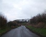
place

Hinton Charterhouse Pit

English Site of Special Scientific Interest stubsSites of Special Scientific Interest in AvonSites of Special Scientific Interest notified in 1971Somerset geography stubs

Hinton Charterhouse Pit (grid reference ST772573) is a 0.4 hectare geological Site of Special Scientific Interest near the village of Hinton Charterhouse, Bath and North East Somerset, notified in 1971. The Hinton Sands, where a sparse bivalve fauna has been found, is an unusual sandy facies developed in the middle of the Forest Marble Jurassic Formation. This rock unit has strong associations with William Smith, who used the name Hinton Sands for the facies early in the 19th century.

Excerpt from the Wikipedia article Hinton Charterhouse Pit (License: CC BY-SA 3.0, Authors).

Hinton Charterhouse Pit
B3110,

Geographical coordinates (GPS) Address Nearby Places
placeShow on map

Wikipedia: Hinton Charterhouse PitContinue reading on Wikipedia

Geographical coordinates (GPS)

Latitude Longitude
N 51.31435 ° E -2.32852 °
placeShow on map

Address

B3110
BA2 7SP
England, United Kingdom
mapOpen on Google Maps

Share experience

Nearby Places

The George Inn, Norton St Philip

The George Inn in Norton St Philip, Somerset, England, one of a number of establishments that claims to be Britain's oldest tavern, is located in the centre of the village. It was built in the 14th or 15th century and has been designated as a Grade I listed building.It was originally built as a wool store for Hinton Priory at nearby Hinton Charterhouse and to accommodate travellers and merchants coming to the annual wool fairs that were held in the village from the late 13th century until 1902. Hinton Priory was one of the ten medieval Carthusian houses (charterhouses) in England. It was first established at Hatherop in 1222 by William Longspee, Earl of Salisbury. The monks disliked the location, and on Longspee's death in 1226 they petitioned his countess for a new site to achieve greater solitude. She gave them her manors of Hinton Charterhouse and Norton St Philip and the new house was consecrated at Hinton Charterhouse in May 1232. A licence to sell alcohol at The George is claimed from 1397, which may have been a local licence from the Prior of Hinton Priory as Governmental licences for alehouses were only introduced in 1552.In the 15th century the timber-framed upper floors were added.The inn became part of the stage coach route between London and South West England. On 12 June 1668 the noted diarist Samuel Pepys, with his wife and servants, passed through Norton St Philip on their way to Bath from Salisbury.The inn was later used as the headquarters of Monmouth's army, during the Monmouth Rebellion in 1685, after his retreat from Bath. In the aftermath of the failed rebellion Judge Jeffreys used the George Inn as a courtroom and conducted 12 executions on the village common, as part of the Bloody Assizes.In 1998 a major programme of restoration was undertaken, funded by the Wadworth Brewery, which included extensive archaeological investigations into the history of the building. This showed that part of the building had been demolished in the 17th century and dendrochronology showed that the roof timbers had been replaced in around 1431. Roof repairs included removing all 29,750 stone slates, 70% of which were able to be reused.The building has been used as a setting for films such as The Remains of the Day, Tom Jones, and The Canterbury Tales, as well as in the television adaptations of Persuasion by Jane Austen and Moll Flanders by Daniel Defoe.

Friary, Somerset
Friary, Somerset

The Friary is a small hamlet outside the English village of Freshford, about 6 miles (10 km) south of Bath, Somerset. Although closer to Freshford it lies within the parish of Hinton Charterhouse. The hamlet consists of two small fields named Church Close and Corn Close, which are bounded to the south by Friary Wood and to the north by the River Frome. There are five detached houses which are accessed by a narrow lane about 0.5 miles (0.8 km) long, known locally as the causeway, which descends steeply through Friary Wood from the Warminster Road originally called the Black Dog Turnpike. The name Friary comes from its relationship to the Carthusian priory at Hinton Charterhouse about one mile away, and was where the lay brothers lived. A larger village south of Frome called Witham Friary also has connections to the Carthusians. On some early texts and Ordnance Survey maps it is shown as Friary Green. An early map of Somerset dated 1782 records the name as Friery Green. But today it is known locally as simply Friary or The Friary. There are very little standing archaeological remains of the buildings used and lived in by the lay brothers but there is evidence of contemporary construction in one of the remaining cottages and the remains of a mill adjacent to the river Frome are still visible. The church of Church Close has disappeared and is thought to have been robbed of its stone to build the later mill at nearby Iford. However, examples of the stonemasons' art are regularly unearthered, including window tracery and mullions, and door surrounds which could only have come from a high status building such as a church. There is also evidence of fish ponds and buried walls belonging to other structures built during the lay brothers' occupation. The site has never been subject to detailed archaeological investigation. The lay brothers abandoned the site some time before the dissolution of the monasteries and it later became part of the Hinton Abbey Farm estate. A map of Hinton Abbey Farm dated 1785 shows dwellings now long since demolished together with the names of their occupants or tenants. Two of the names appearing on this map are Swift and Humphrys. These families were related. Both Swift and Humphrys (now spelt Humphries) were living in Friary (in the same dwelling) according to the 1901 census and Humphries were living in the nearby village of Hinton Charterhouse until the late 1900s. One Mercy Swift, recorded on the 1901 census as 14 years old, was still living in Friary until the 1950s when the house she occupied was demolished as unfit. At that time it had neither electricity nor running water. Water had to be fetched from a nearby spring known as Ela's Well which itself has significant legendary connections with the founding of the monastery at nearby Hinton. Ela was Countess of Salisbury and in addition to founding the priory at Hinton she also founded the abbey at Lacock. Today many of the dwellings in Friary still derive water supplies from a local spring although it now arrives via a network of pipes. Mercy Swift's house or at least the ruins of it are still visible alongside the bridle path that links Friary to Freshford and in spring her hidden garden still produces an unexpected show of spring bulbs.

Wellow Brook
Wellow Brook

The Wellow Brook is a small river in Somerset, England. It rises near Ston Easton Park in the village of Ston Easton and flows east to Midsomer Norton. West of Radstock, it is joined by the River Somer and a tributary from Kilmersdon (formed itself from Snails Brook and Kilmersdon Brook) to the south. It then flows through Wellow before joining the Cam Brook at Midford to form Midford Brook, before joining the River Avon close to the Dundas Aqueduct. The Environment Agency does not recognise the Midford Brook, instead identifying the Wellow Brook as continuing to the Avon. On this basis the length of the Wellow Brook, from Radstock to the Avon, is 17.8 km (11.1 mi).Alongside the brook are remains of the Somerset Coal Canal which served the Somerset Coalfield in the 19th century. The valley sides are rounded and undulating through erosion. There are several springs dotted along the valley sides and the resultant streams are often lined with trees. The junction of the valley sides with the base is usually gentle and rounded and the valley floors are narrow but flat with the brooks meandering freely across their flood plain. The brook is quite deep in places and frequently has steep sides. This was taken advantage of in making anti-tank defences during World War II when many concrete bunkers known as pillboxes were built as part of the GHQ Line to defend against an expected German invasion.The area is of interest to the Cam Valley Wildlife Group.