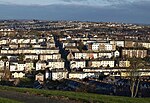
Camels Head Halt railway station
Disused railway stations in Plymouth, DevonFormer Plymouth, Devonport and South Western Junction Railway stationsPages with no open date in Infobox stationRailway stations in Great Britain closed in 1942Railway stations in Great Britain opened in 1906 ... and 1 more
Use British English from October 2018
Camels Head Halt railway station, named after a local public house in Plymouth, was opened as part of the city's suburban network by the London and South Western Railway in 1906, closing in 1942. It was located on the outskirts of the city in sight of the Great Western Railway main line that crossed the River Tamar by the Royal Albert Bridge.
Excerpt from the Wikipedia article Camels Head Halt railway station (License: CC BY-SA 3.0, Authors).Camels Head Halt railway station
Ferndale Road, Plymouth Weston Mill
Geographical coordinates (GPS) Address Nearby Places Show on map
Geographical coordinates (GPS)
| Latitude | Longitude |
|---|---|
| N 50.395 ° | E -4.174 ° |
Address
Ferndale Road 60
PL2 2EJ Plymouth, Weston Mill
England, United Kingdom
Open on Google Maps


