place

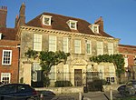
Salisbury Infirmary

1767 establishments in EnglandDefunct hospitals in EnglandEngvarB from October 2013Georgian architecture in WiltshireGrade II listed buildings in Wiltshire
Hospital buildings completed in the 18th centuryHospitals in Wiltshire
Salisbury, the old infirmary geograph.org.uk 1000313

The Salisbury Infirmary was a hospital at Fisherton Street in Salisbury, Wiltshire, England, from 1767 until 1993.

Excerpt from the Wikipedia article Salisbury Infirmary (License: CC BY-SA 3.0, Authors, Images).

Salisbury Infirmary
Cathedral Views, Salisbury Harnham

Geographical coordinates (GPS) Address Nearby Places
placeShow on map

Wikipedia: Salisbury InfirmaryContinue reading on Wikipedia

Geographical coordinates (GPS)

Latitude Longitude
N 51.0678 ° E -1.8009 °
placeShow on map

Address

Cathedral Views
SP2 7TW Salisbury, Harnham
England, United Kingdom
mapOpen on Google Maps

Salisbury, the old infirmary geograph.org.uk 1000313
Share experience

Nearby Places

Hemingsby House
Hemingsby House

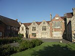
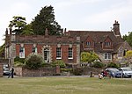
Hemingsby House is a Grade I listed, 14th-century house in Salisbury, England, in the north-west corner of Salisbury Cathedral Close, overlooking Choristers' Green. Although constructed as one house, it has two parts in different architectural styles, giving the impression of two separate buildings. In modern times it has been altered to provide two separate houses. It is generally believed to have been built in the 14th century by Alexander de Hemyngsby, the first recorded warden of the Choristers' School in 1322. Apart from the chapel, most of the building was reconstructed in the middle of the 15th century by Nicholas Upton. He was succeeded by Thomas Fideon who completed the reconstruction and whose name appears on some architectural decorations in the house.Edward Powell lived at Hemyngsby in 1525. He served as counsel to Queen Catherine of Aragon at the hearing of Henry VIII's divorce suit against her. Powell met with much disapproval from Henry, and after Catherine's death he was tried for treason in London and hanged, drawn and quartered at Smithfield.In 1547–1550 the house was occupied by the Reverend Simon Symonds who may have been the vicar of Bray in the traditional folksong.The south part of the house, No 56B, was partly rebuilt in 1727 by Canon Joseph Sayer to replace a decaying previous extension. It has a prominent parapet with panels, even stone quoins on the front and an arched door surrounded by rusticated quoins with a semi-circular fanlight above it. There are four sash windows with stone keystones and four windows to the semi-basement. Stone steps lead up to the front door. The roof is hipped front to back and medieval stone has been used to construct the rear façade.No 56A has a pitched, tiled roof with two dormers, a brick, rubble stone and flint dressed façade with four windows. The north wall contains many tiles laid in herring-bone pattern. The porch has a gable decorated with carved stone shields and a round arch over the door. In 1840 the number of residentiary canons at the cathedral was reduced from six to four, and Hemingsby ceased to be a canonry in 1848 on the death of the then resident, the Reverend Matthew Marsh.The house was designated as Grade I listed in 1952.

Old Sarum Way
Old Sarum Way

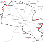
Old Sarum Way is a 32-mile (51 km) long-distance footpath in Wiltshire, England that forms a circle around the city of Salisbury. The route uses public roads, public rights of way and some newly created permitted paths. Some sections of the footpath are waymarked by a metal plate attached to wooden posts which show a picture of the cathedral spire. This is the best guess of the route (clockwise) based on surviving waymarks: SU074337 Head down the hill on the footpath, under the railway line then across the river into South Newton. SU088344 Climb the hill, passing the communication tower and crossing the A360. SU124353 Join the Monarch's Way. SU167337 Turn south. SU162329 Turn east into Old Malthouse Lane. SU170330 Turn south onto the bridleway; the path crosses the A30 and passes south on the hill above Laverstock. SU160297 Join the Clarendon Way. SU185302 Follow the footpath then the permissive path though the Clarendon Estate. SU193280 Turn south and follow Clarendon Lane then Folly Lane. SU183268 Turn onto the bridleway and pass south of Whaddon to SU195261. Turn south following approximately the disused railway line. SU194238 Turn west then join Witherington Road. SU189239 Turn onto the footpath through the woods and cross the river. SU176238 Join the Avon Valley Path northwards. SU129282 Turn left and head towards Salisbury Racecourse.The waymarks for the western section are missing. The most likely route is that the path crosses the A30 between Wilton and Burcombe, then heads north into Grovely Wood.