Colcot
Neighbourhoods of Barry, Vale of GlamorganPages containing links to subscription-only contentUse British English from July 2015

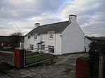
Colcot is a northern district of Barry, Vale of Glamorgan, in the Dyfan ward of South Wales. Dyfan ward is situated in the north west of Barry and its most northern edge is on the green belt of the town. Port Road West runs through the ward and is the main route to Cardiff and Cardiff International Airport in Rhoose. Dyfan benefits from a sports centre and Buttrills recreation field and The Barry Hospital can be found on Colcot Road. It also contains the Colcot Primary School, the Colcot Arms pub, the St David's Methodist Church, Coastlands Family Church, a fish and chip shop/Chinese takeaway, Barry Arts Centre and Merthyr Dyfan Cemetery.
Excerpt from the Wikipedia article Colcot (License: CC BY-SA 3.0, Authors, Images).Colcot
Harlech Gardens,
Geographical coordinates (GPS) Address Nearby Places Show on map
Geographical coordinates (GPS)
| Latitude | Longitude |
|---|---|
| N 51.418888888889 ° | E -3.2797222222222 ° |
Address
Harlech Gardens
Harlech Gardens
CF62 9UW , Merthyr Dyfan
Wales, United Kingdom
Open on Google Maps


