Altforst
AC with 0 elementsGelderland geography stubsPopulated places in GelderlandWest Maas en Waal

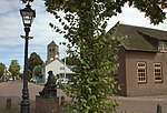
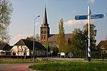
Altforst is a village in the Dutch province of Gelderland. It is a part of the municipality of West Maas en Waal, and lies about 10 km north of Oss. It was first mentioned in 1134 as Altfurse, and means "old settlement near furze (ulex europaeus)". The village started as a deforestation settlement. It was a low-lying area, and therefore, three artificial mounds have been erected in the village. The Dutch Reformed Church dates from 1824 and was decommissioned in 1970. In 1840, it was home to 281 people. The Roman Catholic Church dates from 1891 and is the replacement of a barn church.
Excerpt from the Wikipedia article Altforst (License: CC BY-SA 3.0, Authors, Images).Altforst
Kerkdwarsstraat, West Maas en Waal
Geographical coordinates (GPS) Address Nearby Places Show on map
Geographical coordinates (GPS)
| Latitude | Longitude |
|---|---|
| N 51.85 ° | E 5.5666666666667 ° |
Address
Kerkdwarsstraat 3
6628 AD West Maas en Waal
Gelderland, Netherlands
Open on Google Maps


