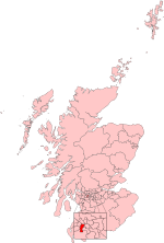
Priesthill
Areas of GlasgowUse British English from May 2015

Priesthill (Scottish Gaelic: Cnoc an t-Sagairt) is a neighbourhood in the south of the River Clyde in the Scottish city of Glasgow. It falls under the Greater Pollok ward of the city council area. The Darnley neighbourhood is located to the south, on the opposite side of the Glasgow South Western Line railway (both areas are served by Priesthill and Darnley railway station), while Nitshill lies to the west and Househillwood and the Silverburn Centre shopping complex to the north. The M77 motorway runs to the east of Priesthill with open farmland beyond.
Excerpt from the Wikipedia article Priesthill (License: CC BY-SA 3.0, Authors, Images).Priesthill
Priesthill Road, Glasgow Priesthill
Geographical coordinates (GPS) Address Nearby Places Show on map
Geographical coordinates (GPS)
| Latitude | Longitude |
|---|---|
| N 55.815764 ° | E -4.343219 ° |
Address
Priesthill Road
Priesthill Road
G53 6PZ Glasgow, Priesthill
Scotland, United Kingdom
Open on Google Maps


