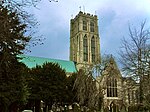
Knedlington

Knedlington is a small hamlet and former civil parish, now in the parish of Asselby, in the East Riding of Yorkshire, England. It is situated approximately 1 mile (1.6 km) west of the market town of Howden and lies to the west of the B1228 road. The M62 motorway is just over 1 mile to the south-east. Village landmarks include Knedlington Manor, Knedlington Hall, and woodland. Knedlington Hall was protected as a Grade II* listed building in 1966. In 1931 the parish had a population of 86.In 1823 Knedlington was in the civil parish of Howden and the Wapentake Liberty of Howdenshire. Recorded was the hall built in the reign of Elizabeth I at the west of the village. Population at the time was 118. Occupations included a farmer and a horse dealer, and the landlord of the Anchor public house. Resident was a gentleman and two yeoman, one of whom was the chief constable and agent to a London insurance company.Knedlington was formerly a township in the parish of Howden, from 1866 Knedlington was a civil parish in its own right, on 1 April 1935 the parish was abolished and merged with Asselby, Howden, Eastrington and Kilpin.
Excerpt from the Wikipedia article Knedlington (License: CC BY-SA 3.0, Authors, Images).Knedlington
Geographical coordinates (GPS) Address Nearby Places Show on map
Geographical coordinates (GPS)
| Latitude | Longitude |
|---|---|
| N 53.74377 ° | E -0.889612 ° |
Address
DN14 7EU , Asselby
England, United Kingdom
Open on Google Maps


