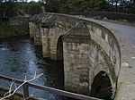
Darley Dale
Derbyshire DalesTowns and villages of the Peak DistrictTowns in Derbyshire

Darley Dale, also known simply as Darley, is a town and civil parish in the Derbyshire Dales district of Derbyshire, England, with a population of 5,413. It lies north of Matlock, on the River Derwent and the A6 road. The town forms part of a built up area with both Matlock and Rowsley.
Excerpt from the Wikipedia article Darley Dale (License: CC BY-SA 3.0, Authors, Images).Darley Dale
South Park Avenue, Derbyshire Dales
Geographical coordinates (GPS) Address Nearby Places Show on map
Geographical coordinates (GPS)
| Latitude | Longitude |
|---|---|
| N 53.166 ° | E -1.596 ° |
Address
South Park Avenue
South Park Avenue
DE4 2FY Derbyshire Dales
England, United Kingdom
Open on Google Maps


