place

Upper Thurne Broads and Marshes

Hickling, NorfolkNational nature reserves in EnglandNature Conservation Review sitesRamsar sites in EnglandSites of Special Scientific Interest in Norfolk
Special Areas of Conservation in EnglandSpecial Protection Areas in England
Hickling Broad
Hickling Broad

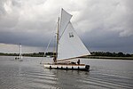
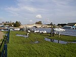
Upper Thurne Broads and Marshes is a 1,185.9-hectare (2,930-acre) biological Site of Special Scientific Interest north of Great Yarmouth in Norfolk. Part of it is a Nature Conservation Review site, Grade I, and it is in the Norfolk Coast Area of Outstanding Natural Beauty. It is part of the Broadland Ramsar site and Special Protection Area, and The Broads Special Area of Conservation. Two areas, Hickling Broad and Martham Broad, are national nature reserves managed by the Norfolk Wildlife Trust.This is one of the finest wetland complexes in Britain, and it is internationally important for its wetland plant communities and associated animal species. It has four lakes, Hickling Broad, Heigham Sound, Horsey Mere and Martham Broad, together with smaller water bodies, swamp, fen, woodland and grazing marsh.

Excerpt from the Wikipedia article Upper Thurne Broads and Marshes (License: CC BY-SA 3.0, Authors, Images).

Upper Thurne Broads and Marshes
Hickling Broad reserve path, North Norfolk Hickling

Geographical coordinates (GPS) Address Nearby Places
placeShow on map

Wikipedia: Upper Thurne Broads and MarshesContinue reading on Wikipedia

Geographical coordinates (GPS)

Latitude Longitude
N 52.734 ° E 1.605 °
placeShow on map

Address

Hickling Broad reserve path

Hickling Broad reserve path
NR12 0BP North Norfolk, Hickling
England, United Kingdom
mapOpen on Google Maps

Hickling Broad
Hickling Broad
Share experience

Nearby Places

Lambridge Mill
Lambridge Mill

Lambridge Mill also known as Lambrigg Mill is a wind pump located in the parish of Sea Palling within the Norfolk Broads National Park, United Kingdom and can be found at grid reference grid reference TG431252, it is approximately 2 miles southwest of Waxham. The wind pump is a grade II listed building.The current wind pump at this location was built c. 1865 and it fell out of use around 1937. The Mill was built to drain the nearby Long Gore Marsh (located to the south of the mill) along with the Brograve Levels as a helper mill for its much older neighbour Brograve Mill. Both this mill and Brograve Mill drained the levels into the Waxham New Cut via the same drainage channel. The name of the mill is also somewhat disputed, as the current Ordnance Survey Explorer map states the name of the mill as Lambrigg Mill. The name Lambridge, however, corresponds with the names of the nearby Lambridge Mill Farm and Lambridge Mill Cottage. The mill still stands today in a derelict state with only two of the original four stocks remaining, these being precariously perched on top of the brickwork attached to the exposed iron windshaft. Only a small rotten section of the original cap remains. It is difficult to directly reach the mill due to it being located within the private garden of Lambridge Mill Cottage; no public rights of way run nearby. However, it is possible to get relatively close to the structure via the Waxham New Cut, the mill is well beyond the limit of navigation, therefore only small non-motorised craft may venture this far up the river.