place

North Port railway station

1987 disestablishments in AustraliaDisused railway stations in MelbourneMelbourne rail transport stubsRailway stations closed in 1987Railway stations in Australia opened in 1859
Use Australian English from February 2015Victoria (Australia) railway station stubs

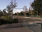
North Port was a railway station on the first significant railway in Australia. Though it was closed in 1987, Melbourne tram route 109 now runs through the former location of the station. The station was located to the south of Raglan street and between Evans street and Station street.

Excerpt from the Wikipedia article North Port railway station (License: CC BY-SA 3.0, Authors).

North Port railway station
Sandridge Rail Trail, Melbourne Port Melbourne

Geographical coordinates (GPS) Address External links Nearby Places
placeShow on map

Wikipedia: North Port railway stationContinue reading on Wikipedia

Geographical coordinates (GPS)

Latitude Longitude
N -37.833333333333 ° E 144.94333333333 °
placeShow on map

Address

Stop 127: North Port

Sandridge Rail Trail
3207 Melbourne, Port Melbourne
Victoria, Australia
mapOpen on Google Maps

linkWikiData (Q7056404)
linkOpenStreetMap (217510683)

Share experience

Nearby Places

North Port Oval
North Port Oval

North Port Oval, also known as the Port Melbourne Cricket Ground or by the sponsored name ETU Stadium, is an Australian rules football and cricket stadium located in Port Melbourne, Australia. The capacity of the venue is 12,000 people. It is home to both the Port Melbourne Cricket Club and the Port Melbourne Football Club. The ground is one of the Victorian Football League primary venues, and each year, it will usually host two finals in the first week, then both semi-finals and both preliminary finals. This has been the case almost continuously since 1996. The ground has hosted a total of seven VFA/VFL top division Grand Finals: in 1931, 1963, 1964, 1965, 1997, 1998 and 1999. The crowd record estimated to be 32,000 witnessed the 1953 Sunday Amateur League Grand Final between Montague and Carlton; the ground's highest VFA crowd of 26,000 was set at the 1964 Division 1 Grand Final between Port Melbourne and Williamstown. On 12 November 1927 the foundation stone for the main grandstand was laid by the Mayor of the City of Port Melbourne, Cr. A.Tucker JP. In the 1970s the main grandstand was named the Norman L Goss Stand in honour of long-time Port Melbourne Football Club administrator Norm Goss Sr. On 30 May 2015 the redevelopment of the oval and facilities was officially opened by Mayor Cr. A.Stevens and Hon. Martin Foley MP (Member for Albert Park), with funding from City of Port Phillip, Port Melbourne Football Club, the AFL, AFL Victoria, and Victorian Government. The ground is now also home to the Sandridge Events Centre, located at the Woodriff St end of the ground. In 2014, the ends of the ground were renamed to honour of the Port Melbourne Football Club's two champion goalkickers, Fred Cook (1210 goals) and Bob Bonnett (933 goals). The Woodruff St end is known as the Fred Cook End, and the Williamstown Rd end is known as the Bob Bonnett end.The ground has been known by several sponsored names during the 21st century. It is presently known as ETU Stadium under a sponsorship deal with the Electrical Trades Union of Australia. Under its longest-lasting name, it was known as TEAC Oval from 2000 until 2011. It has previously had short term naming rights deals lasting only the end of the home and away season and the finals as Fortburn Stadium in 2017 and Stannards Stadium in 2018; and for the full season in 2019 as Adcon Stadium.

Charles Grimes Bridge

The Charles Grimes Bridge is a dual-carriageway bridge that carries the Docklands Highway over the Yarra River in the Docklands precinct of Melbourne, Australia. It was named after New South Wales surveyor general Charles Grimes, who was the first European to see the Yarra River. This crossing of the Yarra River was located approximately 700m downstream of the Spencer Street Bridge, supporting dual four-lane structures; the Country Roads Board (later VicRoads) began construction on the bridge and its approach roads in January 1975. It connected Footscray Road on the northern side of the river to Johnson, Lorimer, Montague and Brady Streets on the south side of the river, and was designed to be compatible with a future extension of the West Gate Freeway. The low clearance of the new bridge over the water would prevent shipping access to wharves and dry-dock facilities upstream, resulting in the closure of a number of the river wharves on the upstream side. The bridge was known during the construction as the Johnson Street Bridge, and was opened under that name by the Acting Minister of Transport, the Hon A H Scanlan MP, on 4 August 1978, with the total cost of the bridge and approach works at approximately $30 million; it was renamed the Charles Grimes Bridge in 1983.With the Melbourne Docklands redevelopment of the 1990s, Footscray Road was closed as a through-route and rebuilt as Harbour Esplanade, with Wurundjeri Way was constructed to the east as a replacement route. To connect to this new road, Flinders Street was upgraded, and the north end of the Charles Grimes Bridge was rebuilt on an easterly curve to connect to it. Reconstruction started in June 1999, and was completed by 2001. The bridge superstructure consists of five 33.5m long main spans the river, with five smaller spans between 12m and 24m in length over the existing wharf and riverbank. Each of the bridges carries four traffic lanes in one direction, and a footpath. Computer analysis was required during design due to the complex geometry of the spans.The Jim Stynes Bridge was opened in 2014 to carry pedestrian and cyclist traffic underneath the Charles Grimes Bridge, to connect the Docklands precinct to the Northbank area.