place

Fort Bute

1766 establishments in the British Empire1779 disestablishments in the Spanish Empire1779 in the United StatesBattles involving Great BritainBattles involving Spain
Battles of the Anglo-Spanish War (1779–1783)British-American culture in LouisianaBritish forts in the United StatesColonial forts in LouisianaConflicts in 1779East Baton Rouge Parish, LouisianaLouisiana in the American RevolutionMilitary installations closed in 1779Military installations established in 1766Pre-statehood history of Louisiana
West Florida Map 1767

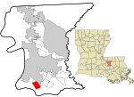
Fort Bute (1766–1779) was a colonial fort built by the British in 1766 to protect the confluence of Bayou Manchac with the Mississippi River and was named in honor of the Earl of Bute. Fort Bute was located on Bayou Manchac, about 115 miles (185 km) up the Mississippi River from New Orleans, on the far western border of British West Florida. It was one of the three outposts maintained by the British in the lower Mississippi along with Fort Panmure and the Baton Rouge outpost.

Excerpt from the Wikipedia article Fort Bute (License: CC BY-SA 3.0, Authors, Images).

Fort Bute
River Road, Baton Rouge

Geographical coordinates (GPS) Address Nearby Places
placeShow on map

Wikipedia: Fort ButeContinue reading on Wikipedia

Geographical coordinates (GPS)

Latitude Longitude
N 30.323611111111 ° E -91.136944444444 °
placeShow on map

Address

River Road

River Road
70820 Baton Rouge
Louisiana, United States
mapOpen on Google Maps

West Florida Map 1767
Share experience

Nearby Places

Sunshine, Louisiana

Sunshine is a populate place in Iberville Parish, Louisiana, United States which is now partially within the city limits of St. Gabriel. Located approximately 15 miles south of Baton Rouge along the Mississippi River, the community was originally named Forlorn Hope by inhabitants but was given its current name by Oscar Richard, Sr., who was the post master of the Forlorn Hope, La. post office. He petitioned the federal government for permission to change the name of the post office to Sunshine, La., in order to give it a more uplifting name. As frequently happens, the villages took the name of the local post office; hence, the name of the village and community became known as Sunshine, La. Much of the community annexed was annexed to St. Gabriel in 1987, excluding a peninsual along the river. The ZIP Code for Sunshine is 70780.The "Sunshine" type of vetiver grass, whose roots have long been used in Louisiana as an insect repellent, was given that name by the USDA in 1989 for Sunshine, Louisiana, where Eugene LeBlanc Sr. grew a heritage clone given to his grandparents by Felix Perilloux, who in turn had acquired it from his wife Myrthee Froisy Perilloux in the 1860s. Vetiver was clonally introduced throughout the tropics in the 19th century, and DNA fingerprinting has shown that almost all the vetiver grown worldwide for perfumery, agriculture, and bioengineering is essentially the same nonfertile cultigen as Sunshine. This type of essential-oil vetiver is known by various names in different locations (e.g., 'Monto' in Australia), but because "Sunshine" was the earliest name used in modern times, that is how it is collectively known throughout the world today.