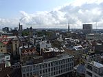
Mary le Port Street, Bristol

Mary le Port Street (also known as St Mary le Port Street, Maryleport Street or Maryport Street) was an important thoroughfare from an early stage in the development of the settlement of Bristol, England, linking the area around St Peters Church and, later, Bristol Castle with the Saxon core of the town to the west at High Street, Wine Street, Corn Street and Broad Street. It was heavily damaged by aerial bombing in 1940, and was relegated to an unnamed service road and footway in post-war reconstruction of the area. Recent versions of the Bristol Local Plan have sought to re-instate this street and some of the surrounding historic street layout, to improve the link between the shopping area of Broadmead and the St Nicholas Market area.
Excerpt from the Wikipedia article Mary le Port Street, Bristol (License: CC BY-SA 3.0, Authors, Images).Mary le Port Street, Bristol
Bridge Street, Bristol Broadmead
Geographical coordinates (GPS) Address Nearby Places Show on map
Geographical coordinates (GPS)
| Latitude | Longitude |
|---|---|
| N 51.4548 ° | E -2.5915 ° |
Address
Saint Mary-le-Port Church
Bridge Street
BS1 2AW Bristol, Broadmead
England, United Kingdom
Open on Google Maps


