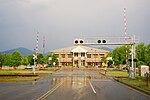
Mills River (North Carolina)
The Mills River is located in Transylvania and Henderson counties, North Carolina, United States is a tributary of the French Broad River. The river flows out of the Pisgah Ranger District of the Pisgah National Forest in two forks: the North Fork, which drains the slopes just south of the Blue Ridge Parkway between Asheville and Mount Pisgah, and the South Fork, which drains the area of the Pisgah Ranger District just east of the Cradle of Forestry in America, including the slopes of Black Mountain. The Mills River flows into the French Broad River northwest of Hendersonville between NC 191 and Interstate 26. The North Mills River Recreation Area, located on the North Fork of the river, is a popular local attraction for camping, hiking, and fishing. The Mills River is used as a water source for the cities of Asheville and Hendersonville.
Excerpt from the Wikipedia article Mills River (North Carolina) (License: CC BY-SA 3.0, Authors).Mills River (North Carolina)
Glenheath Drive,
Geographical coordinates (GPS) Address Nearby Places Show on map
Geographical coordinates (GPS)
| Latitude | Longitude |
|---|---|
| N 35.388611111111 ° | E -82.531944444444 ° |
Address
Glenheath Drive
Glenheath Drive
28791
North Carolina, United States
Open on Google Maps


