Asheville Regional Airport

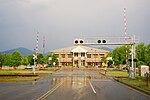
Asheville Regional Airport (IATA: AVL, ICAO: KAVL, FAA LID: AVL) is a Class C airport near Interstate 26 and the town of Fletcher, North Carolina, 9 miles (14 km) south of downtown Asheville. It is owned by the Greater Asheville Regional Airport Authority. The Federal Aviation Administration (FAA) National Plan of Integrated Airport Systems for 2019–2023 categorized it as a small-hub primary commercial service facility. In 2022 it served an all-time record number of passengers for the airport, 1,838,793, an increase of 29% over 2021.The airport opened initially with a 6500-foot runway in 1961, replacing the former airport at 35.439°N 82.481°W / 35.439; -82.481 (Former airport serving Asheville).
Excerpt from the Wikipedia article Asheville Regional Airport (License: CC BY-SA 3.0, Authors, Images).Asheville Regional Airport
Hidden Creek Road,
Geographical coordinates (GPS) Address External links Nearby Places Show on map
Geographical coordinates (GPS)
| Latitude | Longitude |
|---|---|
| N 35.436111111111 ° | E -82.541666666667 ° |
Address
Asheville Regional Airport
Hidden Creek Road
28704
North Carolina, United States
Open on Google Maps


