Barren Fork Coal Camp and Mine Archeological District
1879 establishments in Kentucky1935 disestablishments in KentuckyArchaeological sites on the National Register of Historic Places in KentuckyBuildings and structures completed in 1879Coal mining in Appalachia ... and 5 more
Coal towns in KentuckyEastern Kentucky Coalfield Registered Historic Place stubsHistoric districts on the National Register of Historic Places in KentuckyNational Register of Historic Places in McCreary County, KentuckyUse mdy dates from August 2023
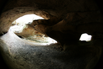
The Barren Fork Coal Camp and Mine Archeological District is a 210 acres (0.85 km2) historic district near Whitley City, Kentucky which was listed on the National Register of Historic Places in 1997. It is also designated 15MC808 and 15MC809.It is presumably located near or on Barren Fork Rd., north of Whitley City. The Barren Fork Cemetery is the most visible surviving element of the community.
Excerpt from the Wikipedia article Barren Fork Coal Camp and Mine Archeological District (License: CC BY-SA 3.0, Authors).Barren Fork Coal Camp and Mine Archeological District
Barren Fork Cemetery Road,
Geographical coordinates (GPS) Address Nearby Places Show on map
 Continue reading on Wikipedia
 Geographical coordinates (GPS)
| Latitude | Longitude |
|---|---|
| N 36.7775 ° | E -84.468611111111 ° |
Address
Barren Fork Cemetery Road
Barren Fork Cemetery Road
Kentucky, United States
Open on Google Maps