Ramstein Castle (Kordel)

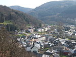
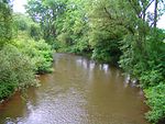
The ruins of Ramstein Castle (German: Burg Ramstein) stand on a 182-metre-high, Bunter sandstone rock on the edge of the Meulenwald forest in the lower, steep-sided Kyll valley near Kordel in the German state of Rhineland-Palatinate. It stands 9 kilometres (5.6 mi) north of Trier and the same east of Luxembourg. The hill castle was built in the early 14th century by the Archbishop of Trier, Diether of Nassau as the successor to a fortified manor farm. From then on, it was a fief castle of the Electorate of Trier which was enfeoffed (subleased) to electoral subjects and cathedral deans. During the War of the Palatine Succession, the castle was occupied by French troops and largely blown up in 1689. The great damage was not repaired. However, tall sections of curtain walls, elements of corner towers and almost of all the exterior and the stone staircases of its medieval tower house stand. Three larger-footprint modern buildings including a hotel-restaurant are on the southern part of the east-facing promontory. The hotel's outdoor terrace overlooks the lightly or densely wooded valley, depending on direction views. Fields have likely long stood next to the near-bend of the river enabling a clear view to the impassably sheer hillside (on horseback) on the opposite bank and intervening north–south route.
Excerpt from the Wikipedia article Ramstein Castle (Kordel) (License: CC BY-SA 3.0, Authors, Images).Ramstein Castle (Kordel)
Aufstieg Burg Ramstein, Trier-Land
Geographical coordinates (GPS) Address External links Nearby Places Show on map
Geographical coordinates (GPS)
| Latitude | Longitude |
|---|---|
| N 49.823777777778 ° | E 6.6440833333333 ° |
Address
Burg Ramstein
Aufstieg Burg Ramstein
54306 Trier-Land
Rhineland-Palatinate, Germany
Open on Google Maps


