Angel Street, London

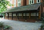
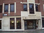
Angel Street, formerly known as Angel Alley, Angel Court, and Angell Street, is a street in the City of London that runs between King Edward Street in the west and St Martin's Le Grand in the east. Although dating back to at least 1542, no original buildings now remain due to the effects of the Great Fire of London, the London Blitz, and redevelopment. Buildings in the street were damaged in the Great Fire of 1666 when Poulterer's Hall was destroyed, and in the early nineteenth century many buildings were demolished for redevelopment and due to their "ruinous" state. The Angel Inn, which dated from the 17th century, survived on the north side until around 1840. In the late nineteenth century, the General Post Office (West), which included the Central Telegraph Office, was built on the south side of the street and a further post office building soon after replaced the whole of the north side of the street. In 1940, the telegraph office was seriously damaged during the London Blitz and subsequently demolished in 1967. The site is now occupied by the BT Centre (1984) so that today the street consists solely of two long office frontages.
Excerpt from the Wikipedia article Angel Street, London (License: CC BY-SA 3.0, Authors, Images).Angel Street, London
Angel Street, City of London
Geographical coordinates (GPS) Address Nearby Places Show on map
Geographical coordinates (GPS)
| Latitude | Longitude |
|---|---|
| N 51.516111111111 ° | E -0.0975 ° |
Address
Angel Street
Angel Street
EC1A 4BB City of London
England, United Kingdom
Open on Google Maps


