place

Chisholm Park Golf Links

Golf club and course stubsGolf clubs and courses in New ZealandOtago geography stubsSports venues in Dunedin

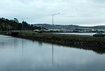
Chisholm Park is a golf club and links course in the New Zealand city of Dunedin. It is located in the southern coastal suburb of Tahuna, close to Andersons Bay Cemetery and the coastal headland of Lawyers Head. The course was created as part of a public works project during the Great Depression of the 1930s, and was officially opened in 1933 as Ocean Beach Links. It was named after former Dunedin mayor Robert Chisholm.The links hosted the New Zealand Amateur Championship in 2003 and Australasian PGA Tour events in 2001, 2002, and 2004. The course is rated highly; it is ranked among the country's top 20 courses, and leading New Zealand golfer Greg Turner has described it as "the second best links course in New Zealand".The course has a par of 71, and measures some 5,700 metres (6,200 yd), with undulating terrain and the challenges of weather associated with links courses. Holes 8 to 14 are regarded as among the best in Otago, with impressive views across both the Pacific and the city's southern suburbs, and hole 9 ("Lawyer’s Head") is considered by many as the country's best golf hole. With both tee and cup on ocean promontories, a straight line between the two crosses open water. The club has some 500 members, and is served by a pro shop and clubhouse. The head pro is Allan Court.The course is naturally sand drained, allowing it to remain open year-round.

Excerpt from the Wikipedia article Chisholm Park Golf Links (License: CC BY-SA 3.0, Authors).

Chisholm Park Golf Links
John Wilson Ocean Drive, Dunedin Saint Kilda

Geographical coordinates (GPS) Address External links Nearby Places
placeShow on map

Wikipedia: Chisholm Park Golf LinksContinue reading on Wikipedia

Geographical coordinates (GPS)

Latitude Longitude
N -45.905555555556 ° E 170.52777777778 °
placeShow on map

Address

Chisholm Park Golf

John Wilson Ocean Drive
9012 Dunedin, Saint Kilda
Otago, New Zealand
mapOpen on Google Maps

linkWikiData (Q48815996)
linkOpenStreetMap (150886869)

Share experience

Nearby Places

Tainui, New Zealand
Tainui, New Zealand

Tahuna and Tainui are two small, somewhat vaguely defined suburbs of the New Zealand city of Dunedin. They lie to the south of Andersons Bay and Musselburgh, close to Dunedin's southern coastline (Ocean Beach). Both are often considered parts of either Musselburgh or Andersons Bay. Tainui lies to the north, in the area of residential housing which lies in the southeastern corner of "The Flat" (southern Dunedin's wide coastal plain) between Victoria and Tahuna Roads in the south and Musselburgh Rise in the north. Its eastern boundary is the start of a section of the Musselburgh Rise skirted by Tainui Road. Notable features of Tainui include Culling Park, a sports ground which is the home of Dunedin Technical football club. To the south of Tainui is Tahuna. This suburb stretches along Victoria and Tahuna Roads, and is largely dominated by several areas of open space which lie to the south between these roads and the ocean. These open spaces include two notable sports venues: Chisholm Park Golf Course and Tahuna Park. Chisholm Park is a championship-standard links course featuring one of New Zealand's finest holes, Lawyers Head. This hole dog-legs around craggy cliffs with the ocean pounding at their feet, and as such is both visually impressive and technically difficult. The course was founded in 1937 and extended from nine to 18 holes in 1941. Tahuna Park houses Dunedin's A&P showgrounds, and was the city's first rugby union and rugby league test venue. The grounds were inaugurated in a 20-acre (8.1 ha) here in 1883, and the park's only union test match was played in 1905, with the All Blacks beating Australia 14-3. The park hosted the 1924 Great Britain side when they defeated the New Zealand rugby league side 31-18 in front of 16,000 fans.The third notable open space close to the coast is the Andersons Bay Cemetery, Dunedin's biggest cemetery. This is located at the southeastern end of Tahuna, and is bounded to the west and south by Chisholm Park Golf Links. The cemetery occupies a prominent rise that juts into the sea as Lawyers Head. The cemetery was opened in 1867, but is now largely full. A crematorium, inaugurated in 1962, occupies a prominent spot close to the cliffs. Beyond the cemetery, Tahuna Road reaches a Y-junction with Tomahawk Road, which descends to the southeast to follow the coast to the suburb of Ocean Grove and rises to the north to meet with Silverton Road, Andersons Bay at that suburb's boundary with Shiel Hill. This area of Tahuna was formerly known as Ocean View, a name which is still occasionally encountered, though this name has fallen out of use due to confusion with the settlement of the same name which lies 15 kilometres (9.3 mi) to the southwest near Brighton.

Andersons Bay Cemetery

Andersons Bay Cemetery is a major cemetery in the New Zealand city of Dunedin. It is located 4 kilometres (2.5 mi) to the southeast of the city centre, on a rocky outcrop which forms the inland part of Lawyers Head, a promontory which juts into the Pacific Ocean. The cemetery is bounded on the western and southern sides by Chisholm Park Golf Links, and to the east by steep slopes which descend to the Tomahawk Lagoon. Despite its name, the cemetery is located in the suburb of Tahuna, which lies immediately to the south of the suburb of Andersons Bay, and almost 1 kilometre (0.62 mi) from the former (now largely reclaimed) bay itself, at the head of the Otago Harbour. The cemetery is the largest in Dunedin, and as such one of the largest in the South Island. In existence by 1867, the cemetery was the city's main burial site from the early twentieth century until the 1980s, and also contains several older sets of remains which were re-interred here from other sites. Since the 1980s, the role of Dunedin's main cemetery has been split between several sites, with the Green Park Cemetery at Waldronville taking the majority of new burials. The crematorium, opened in 1927, is still in use. The Commonwealth War Graves Commission (CWGC) commemorates 2 World War II New Zealand servicemen cremated here.The cemetery originally went by the imposing name of the Eastern Necropolis, but this quickly fell out of favour to be replaced with its current, more prosaic, name. Andersons Bay Cemetery is noted for its large military memorial section, with many ex-servicemen having been buried here. Notable among them are Victoria Cross recipients Duncan Gordon Boyes and Horace Robert Martineau. The latter is one of 64 World War I Commonwealth service personnel buried here whose graves are registered and maintained by the CWGC, who are also responsible for 54 war graves from World War II.The cemetery is also notable for its section of restored gravestones of early Dunedin Chinese settlers. Other prominent people buried in the cemetery include architects Edmund Anscombe and Francis Petre.

Lawyers Head
Lawyers Head

Lawyers Head (often punctuated as the more grammatically correct Lawyer's Head) is a prominent landmark on the coast of Otago, New Zealand. Located within the city of Dunedin, this rocky headland juts into the Pacific Ocean at the eastern end of the city's main beach, Saint Kilda Beach. It is named for the likeness of the cliff face to the profile of a lawyer in traditional legal wig. The promontory, which reaches a height of 34 m, is connected to the city by the road John Wilson Ocean Drive, which runs parallel to the beach. The head itself commands a view across the city's southern suburbs and along the Otago coast for over 80 kilometres to the southwest. On a clear day Nugget Point in The Catlins can be discerned, and the Nugget Point lighthouse's beam can be seen at night. To the east, the suburb of Ocean Grove and the nearby Tomahawk Lagoon lie beneath the headland. John Wilson Ocean Drive was closed from August 2006, to allow construction of the Tahuna Wastewater Treatment Plant outfall. The road closure had an unexpected benefit of stopping suicides from the headland; there were 13 deaths in the 10 years prior. Access to the headland was restored briefly in October 2009, but closed when there was another death less than three days after full access was restored. New Zealand Police Inspector Dave Campbell stated "Lawyer's Head now has the unenviable reputation of having the highest number of deaths by suicide in one location in New Zealand".One of a series of headlands which punctuate much of this section of the Otago coast, it is its proximity to the centre of the city and its distinctive shape which make it particularly well known. Other nearby headlands nearby include the higher 75 m Maori Head, one kilometre to the east, the cliffs along the coast of Forbury Hill three kilometres to the west, the natural arch of Tunnel Beach three kilometres beyond Forbury Hill, and Blackhead, two kilometres to the southwest of Tunnel Beach. These basalt outcrops were all formed during the eruption of the Dunedin Volcano some 12-15 million years ago. The crater of this long-extinct volcano now forms Otago Harbour, and its rim is the ring of hills which circle Dunedin and form the ridge of the Otago Peninsula. Lawyers Head is an integral part of Chisholm Park Golf Links, developed by the city of Dunedin in 1933. The Links has hosted the New Zealand amateur championship, the New Zealand Masters teams event, and many Australasian Tour events and Pro-ams. The course boasts several holes rated among Otago's best, including the ninth hole, also named "Lawyers Head", which is arguably the country's finest hole. This hole follows the curve of the cliffs, such that a direct line between tee and cup passes over the waters below. The promontory is also located close to Andersons Bay Cemetery, which lies immediately inland from Lawyers Head.

Shiel Hill

Shiel Hill is a residential suburb of the New Zealand city of Dunedin. It is located at the southeastern edge of the city's urban area, 3.2 kilometres (2.0 mi) southeast of the city's centre at the western end of the Otago Peninsula, close to the isthmus joining the peninsula to the mainland. As the name suggests, it is situated on the slopes of a hill at the start of the ridge which runs along the spine of the peninsula. The slopes rise to a series of crests generally known collectively as Highcliff, a name also often applied to the last suburban vestiges which remain as Dunedin's urban area becomes the rural land of the peninsula. More accurately, the name is that of a cliff which lies on the Pacific coast of the peninsula 4 kilometres (2.5 mi) east of Shiel Hill. The suburb is almost entirely residential, though there are some retail premises on the suburb's main road, Highcliff Road. These include a small nexus of shops at the southwestern edge of Shiel Hill, at the point where the suburb joins the neighbouring suburb of Andersons Bay. At this point, there is a road junction, with the western end of Highcliff Road meeting four other roads, notably Silverton Street (which leads down into Andersons Bay and is the main route from Shiel Hill to central Dunedin) and Tomahawk Road (which leads to Dunedin's Pacific coastal suburbs of Tahuna and Ocean Grove). Notable features of Shiel hill include Rotary Park, a small public reserve surrounding reservoirs which serve the Peninsula hill suburbs. This park is located above steep slopes which drop 166 metres (545 ft) to the waters of the Otago Harbour close to The Cove, half a kilometre to the north of the park. From Rotary Park, views can be obtained across and along the harbour to central Dunedin to the northwest, Signal Hill to the north, and Port Chalmers to the northeast.The suburb of Shiel Hill hit the news headlines in Dunedin in 1995 after one of Dunedin's most notorious crimes was committed in Every Street, close to the boundary of Shiel Hill and Andersons Bay. The case, in which five of the six members of the Bain family were slain led to one of New Zealand's most prominent causes célèbres after the remaining member of the family, David Bain was arrested for the murders despite evidence indicating that the slayings may well have been a murder-suicide by his father Robin. David Bain was found guilty and served 13 years of a life sentence before succeeding in having the case reopened. His retrial, in 2009, resulted in a verdict of not guilty.