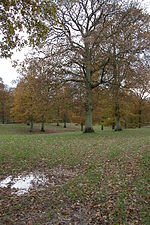
Luxley
Gloucestershire geography stubsHerefordshire geography stubsUse British English from March 2015Villages in GloucestershireVillages in Herefordshire
Luxley is a village in the southwest Midlands of England, on the border between Gloucestershire and Herefordshire near May Hill. Luxley is 12 km (7.5 mi) southeast of Ross-on-Wye and 18 km (11 mi) west of Gloucester. The name has a number of variations. Victorian maps show Luxtre while current place names include Luxtree Farm and Upper Laxtree.
Excerpt from the Wikipedia article Luxley (License: CC BY-SA 3.0, Authors).Luxley
Forest of Dean Longhope
Geographical coordinates (GPS) Address Nearby Places Show on map
Geographical coordinates (GPS)
| Latitude | Longitude |
|---|---|
| N 51.89295 ° | E -2.45915 ° |
Address
GL17 0RG Forest of Dean, Longhope
England, United Kingdom
Open on Google Maps


