New Hampshire Avenue

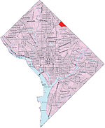
New Hampshire Avenue is a diagonal street in Washington, D.C., beginning at the Kennedy Center and extending northeast for about 5 miles (8 km) and then continuing into Maryland where it is designated Maryland Route 650. New Hampshire Avenue, however, is not contiguous. It stops at 15th and W Streets NW and resumes again on the other side of Columbia Heights at Park Road NW, a few blocks from Georgia Avenue. New Hampshire Avenue passes through several Washington neighborhoods including Foggy Bottom, Dupont Circle, Petworth and Lamond-Riggs. In Maryland, New Hampshire Avenue passes the neighborhoods and towns of Chillum, Takoma Park, Carole Highlands, Langley Park and Silver Spring. Eventually, it feeds into Damascus Road (Maryland Route 108) at Etchison. Many Maryland residents regard New Hampshire Avenue as a convenient access road to Washington's North Capitol Street, a wide road that starts north of the United States Capitol and divides the city into its northwest and northeast quadrants.
Excerpt from the Wikipedia article New Hampshire Avenue (License: CC BY-SA 3.0, Authors, Images).New Hampshire Avenue
New Hampshire Avenue Northeast, Washington Lamond Riggs
Geographical coordinates (GPS) Address Nearby Places Show on map
Geographical coordinates (GPS)
| Latitude | Longitude |
|---|---|
| N 38.962083333333 ° | E -77.005138888889 ° |
Address
Mount Calvary Holy Church
New Hampshire Avenue Northeast 5911
20011 Washington, Lamond Riggs
District of Columbia, United States
Open on Google Maps


