place

Coolidge Senior High School (Washington, D.C.)

1940 establishments in Washington, D.C.District of Columbia Public SchoolsEducational institutions established in 1940NRHPweekly errorsNational Register of Historic Places in Washington, D.C.
Pages with disabled graphsPublic high schools in Washington, D.C.Takoma (Washington, D.C.)
Founders Library, Howard University, NW., Washington, D.C LCCN2010642221

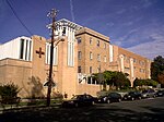
Calvin Coolidge High School is a public high school of the District of Columbia Public Schools system located in the Takoma neighborhood in the Northwest quadrant of Washington, D.C. Its campus is listed on the National Register of Historic Places.

Excerpt from the Wikipedia article Coolidge Senior High School (Washington, D.C.) (License: CC BY-SA 3.0, Authors, Images).

Coolidge Senior High School (Washington, D.C.)
Sheridan Street Northwest, Washington Brightwood

Geographical coordinates (GPS) Address Nearby Places
placeShow on map

Wikipedia: Coolidge Senior High School (Washington, D.C.)Continue reading on Wikipedia

Geographical coordinates (GPS)

Latitude Longitude
N 38.967222222222 ° E -77.019166666667 °
placeShow on map

Address

Coolidge High School

Sheridan Street Northwest
20011 Washington, Brightwood
District of Columbia, United States
mapOpen on Google Maps

Founders Library, Howard University, NW., Washington, D.C LCCN2010642221
Share experience

Nearby Places

Hughes Memorial Tower

The Hughes Memorial Tower is a radio tower in Washington, D.C., at 6001 Georgia Avenue, near the intersection of 9th Street NW and Peabody Street NW. At 761 ft (232 m), it is the tallest structure of any kind in the district, surpassing the Washington Monument by more than 200 ft (61 m) and the WTTG Television Tower by 55 ft (17 m). It is the second-tallest freestanding structure in the Baltimore-Washington metropolitan area, after the 809-foot tall River Road Tower in Bethesda, Maryland.Completed on January 15, 1989, the tower sits at 38°57′47″N 77°1′36″W and at an elevation of 87.7 m (288 ft) above mean sea level. The tower is located on a relatively high spot just off Georgia Avenue NW, in Washington's Brightwood neighborhood, several miles from the city's main cluster of transmission towers in the Tenleytown neighborhood. Except for the 504-foot tower next to it, there are no nearby large structures. For these reasons, as well as its distinctive shape and large size, the tower is visible from a variety of locations in the District of Columbia and suburban Maryland. The tower is owned by the District of Columbia Department of General Services, Portfolio Division. It is used for radio communication by the Washington, D.C., police and fire departments. Until January 2018, it transmitted the WDCW Channel 50 television signal.The three-legged, free-standing star tower shares its design with the Star Tower in Cincinnati, Ohio. It was designed by Texas engineer Henry “Hank” McGinnis, who worked in the Landmark or Adelphon style. It was built by the Landmark Tower Company and named for John S. Hughes, an Assistant D.C. Police Chief who had led the department's adoption of communications technology.The tower has ten daytime strobe beacons on the tower's legs: one beacon per 200 ft (61 m) plus one at the top of the WDCW antenna. The beacons flash at 1.5-second intervals. At nighttime, it flashes red warning navigation lights. The design includes an ichthys, or Jesus fish, developed from early sketches of the structure.In 1998, the National Capital Planning Commission approved a plan to use the Hughes Memorial Tower as part of a 9-1-1 service upgrade. In doing so, it noted that the tower was constructed without its prior permission and that it has caused "concern about the effect of the tower on the views of the major monuments and memorials in the Nation's Capital." The tower has also been criticized by Ward 4 residents because the police "frequently have to close the streets next to this tower because of the risk[s] posed by falling ice" in winter.

Eastern Avenue (Washington, D.C.)

Eastern Avenue is one of three boundary streets between Washington, D.C., and the state of Maryland. It follows a northwest-to-southeast line, beginning at the intersection of 16th Street NW (a north-south street in the District of Columbia) and Colesville Road (a street in Montgomery County in the state of Maryland). It intersects with Blair Road NW, and ceases to exist for about 1,000 feet (300 m). Another interruption occurs at Cedar Street NW. A 3,000-foot (910 m) interruption occurs again at Galloway Street NE, where the park land of the North Michigan Park Recreation Center exists. It continues without interruption until it reaches Bladensburg Road NE. There is a 1.8-mile (2.9 km) interruption in the avenue along Fort Lincoln Cemetery. The avenue has no crossing over New York Avenue NE or the Anacostia River, or through Anacostia Park. It resumes at Kenilworth Avenue NE, with its terminus at its junction with Southern Avenue. Several historic or important buildings are located on Eastern Avenue, and a number of important people once lived on the street. Eastern Avenue forms one of the borders of the Deanwood neighborhood in the District of Columbia, a historic African American community. Several historically important Deanwood-area churches and schools are located on Eastern Avenue. William Pittman, one of the United States' first African American architects and a son-in-law of Booker T. Washington, lived on Eastern Avenue. The Lucinda Cady House (also known as the Cady-Lee House), located at 7064 Eastern Avenue NW, is a restored Queen Anne-Victorian style home built in 1887 which is listed on the National Register of Historic Places. The headquarters of the missionary arm and the relief agency of the worldwide Seventh-day Adventist Church were once located at 6840 Eastern Avenue NW.Eastern Avenue bridges the Anacostia Freeway after its junction with Kenilworth Avenue. The Eastern Avenue Bridge has a clearance of 14 feet (4.3 m), and semi-trailer trucks have struck the bridge numerous times. In November 2009, the District of Columbia announced that it would spend $10.4 million in stimulus funds to replace the bridge with a new precast, 16-foot (4.9 m) high bridge to address these safety concerns.Eastern Avenue appears in several works of crime fiction, because of the higher rate of crime in some of the neighborhoods through which it passes. It is significantly featured in Jim Beame's 2006 short crime story, "Jeannette." Noted Washington, D.C., crime author George Pelecanos used it as a location in his 1996 novel The Big Blowdown, and so did Montana-born author James Grady in his 2007 novel, Mad Dogs.