place

Rifle Street drill hall, Oldham

Buildings and structures in OldhamDrill halls in EnglandManchester Regiment
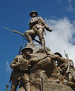
Former Oldham Drill Hall geograph.org.uk 4206668

The Rifle Street drill hall is a former military installation in Oldham.

Excerpt from the Wikipedia article Rifle Street drill hall, Oldham (License: CC BY-SA 3.0, Authors, Images).

Rifle Street drill hall, Oldham
Rifle Street,

Geographical coordinates (GPS) Address Nearby Places
placeShow on map

Wikipedia: Rifle Street drill hall, OldhamContinue reading on Wikipedia

Geographical coordinates (GPS)

Latitude Longitude
N 53.54649 ° E -2.11338 °
placeShow on map

Address

Rifle Street

Rifle Street
OL1 3DQ , Coldhurst
England, United Kingdom
mapOpen on Google Maps

Former Oldham Drill Hall geograph.org.uk 4206668
Share experience

Nearby Places

Oldham
Oldham

Oldham is a town in Greater Manchester, England, it lies amongst the Pennines on elevated ground between the rivers Irk and Medlock, 5 miles (8.0 km) southeast of Rochdale, and 7 miles (11.3 km) northeast of Manchester. It is the administrative centre of the Metropolitan Borough of Oldham, which had a population of 237,110 in 2019. Within the boundaries of the historic county of Lancashire, and with little early history to speak of, Oldham rose to prominence in the 19th century as an international centre of textile manufacture. It was a boomtown of the Industrial Revolution, and among the first ever industrialised towns, rapidly becoming "one of the most important centres of cotton and textile industries in England." At its zenith, it was the most productive cotton spinning mill town in the world, producing more cotton than France and Germany combined. Oldham's textile industry fell into decline in the mid-20th century; the town's last mill closed in 1998. The demise of textile processing in Oldham depressed and heavily affected the local economy. The town centre is the focus of a project that aims to transform Oldham into a centre for further education and the performing arts. It is, however, still distinguished architecturally by the surviving cotton mills and other buildings associated with that industry. In the 2011 United Kingdom census Oldham Built-up area subdivision, as defined by the Office for National Statistics, had a population of 96,555 and an area of 1,687 hectares (6.51 sq mi), giving a population density of 57.2 inhabitants per hectare (14,800/sq mi), while the Borough of Oldham had a population of 224,897, an area of 14,236 hectares (54.97 sq mi), and a population density of 15.8 inhabitants per hectare (4,100/sq mi).

Oldham Parish Church

The Church of St. Mary with St. Peter, mostly known as Oldham Parish Church, is the Church of England parish church for Oldham in Greater Manchester, England. It forms part of the Diocese of Manchester, and is one of several Grade II* listed buildings in Greater Manchester. A church building had existed on the site since 1280. During this time, a small chapel stood on the site to serve the local townships of Oldham, Chadderton, Royton and Crompton. This was later replaced by an Early English Gothic Church in the 15th century. With the coming of the Industrial Revolution, the population of Oldham increased at a rapid rate (from under 2,000 in 1714, to over 32,000 by 1831). The rapid growth of the local population warranted that the building be rebuilt into the current structure. Though the budget was originally agreed at £5,000, the final cost of building was £30,000, one third of which was spent on the crypt structure. Alternative designs by Sir Charles Barry, the designer of the Palace of Westminster, although now regarded by some as superior, were rejected. In 1805 the churchyard was enlarged and nearby Church Lane, Oldham became a cul-de-sac severing an ancient route through the town. The previous continuance of the road (Church Street) was lowered by 6 feet and became an extension of the recently created Church Terrace.The church its present form, dates from 1830 and was designed in the Gothic Revival Style by Richard Lane, a Manchester-based architect. It has been designated by English Heritage as a Grade II* listed building. It was linked with St Mary's Church in Prestwich and together the sites were principal churches of the ancient ecclesiastical parish of Prestwich-cum-Oldham.The peal of twelve bells was cast in 1922 by John Taylor & Co of Loughborough. An additional flat 6th was cast in 1978. The church also retains its original bell, cast in 1722 by Abraham Rudhall II of Gloucester.

Coldhurst
Coldhurst

Coldhurst (or more rarely Cold Hurst) is an area of Oldham and an electoral ward of the wider Metropolitan Borough of Oldham in Greater Manchester, England. At the time of the United Kingdom Census 2001, it had a population of 11,935, increasing to 13,201 at the 2011 Census. The electoral ward spans most of Oldham's town centre, although the name Coldhurst conventionally applies to the area immediately north of the centre. The district of Westwood and a small adjoining part of Chadderton in the Busk area also lie within the Coldhurst ward district. Historically a part of Lancashire, Coldhurst was formerly a chapelry within the ancient ecclesiastical parish of Prestwich-cum-Oldham, in the Salfordshire hundred.An old hall existed in the locality belonging to Abram Crompton Esq, which gave its name to Crompton Street. Coldhurst is said to have been the scene of an action in the English Civil War in which the parliamentarians were defeated.Following the Industrial Revolution, Coldhurst was the site of considerable industry and commerce, including coal mining, cotton spinning and hat manufacture.Coldhurst is the home of a significant community of South Asian (particularly Bangladeshi) heritage. 37% of the population is non-white and most of the white residents live in what have been described as "bleak council developments". In 2001, Coldhurst was in the 5% most deprived wards in the United Kingdom.A photograph of Coldhurst during the Victorian era was used as part of the "Made of Manchester" promotion of the home strip worn by Manchester United F.C. for the 2012–13 season.