Leek and Manifold Valley Light Railway
1904 establishments in England1923 disestablishments in England2 ft 6 in gauge railways in EnglandBritish companies disestablished in 1923British companies established in 1898 ... and 12 more
Closed railway lines in the West Midlands (region)History of StaffordshireLight railwaysLondon, Midland and Scottish Railway constituentsNorth Staffordshire RailwayRail transport in StaffordshireRailway companies disestablished in 1923Railway companies established in 1898Railway lines closed in 1934Railway lines opened in 1904Staffordshire MoorlandsUse British English from December 2016
The Leek and Manifold Valley Light Railway (L&MVLR) was a narrow gauge railway in Staffordshire, England that operated between 1904 and 1934. The line mainly carried milk from dairies in the region, acting as a feeder to the 4 ft 8+1⁄2 in (1,435 mm) standard gauge system. It also provided passenger services to the small villages and beauty spots along its route. The line was built to a 2 ft 6 in (762 mm) narrow gauge and to the light rail standards provided by the Light Railways Act 1896 to reduce construction costs. The route of the line is now a foot- and cycle- path.
Excerpt from the Wikipedia article Leek and Manifold Valley Light Railway (License: CC BY-SA 3.0, Authors).Leek and Manifold Valley Light Railway
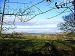
Manifold Track, Staffordshire Moorlands
Geographical coordinates (GPS) Address Nearby Places Show on map
Geographical coordinates (GPS)
| Latitude | Longitude |
|---|---|
| N 53.0484 ° | E -1.8647 ° |
Address
Manifold Track
ST10 3JU Staffordshire Moorlands
England, United Kingdom
Open on Google Maps


