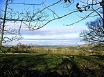
Waterhouses, Staffordshire
Civil parishes in StaffordshireStaffordshire MoorlandsTowns and villages of the Peak DistrictUse British English from June 2013Villages in Staffordshire

Waterhouses is a village in the south of the Staffordshire Peak District in England. It is around 8 miles from Leek and Ashbourne, being nearly the halfway point between the two towns on the A523 road, which roughly follows the southern boundary of the Peak District National Park. Waterhouses is also a civil parish, created in 1934 when the parishes of Calton, Cauldon, Waterfall and part of Ilam were merged; previously the village of Waterhouses was on the boundary of Waterfall and Cauldon parishes. The hamlet of Winkhill is also in the parish. The population of the civil parish at the 2011 census was 1,134.
Excerpt from the Wikipedia article Waterhouses, Staffordshire (License: CC BY-SA 3.0, Authors, Images).Waterhouses, Staffordshire
Ashbourne Road, Staffordshire Moorlands
Geographical coordinates (GPS) Address Nearby Places Show on map
Geographical coordinates (GPS)
| Latitude | Longitude |
|---|---|
| N 53.0497 ° | E -1.8762 ° |
Address
Ashbourne Road
Ashbourne Road
ST10 3JS Staffordshire Moorlands
England, United Kingdom
Open on Google Maps


