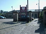
Staincliffe and Batley Carr railway station
1878 establishments in England1952 disestablishments in EnglandDisused railway stations in KirkleesFormer London and North Western Railway stationsPages with no open date in Infobox station ... and 3 more
Railway stations in Great Britain closed in 1952Railway stations in Great Britain opened in 1878Use British English from August 2017

Staincliffe and Batley Carr railway station served the hamlet of Staincliffe and the district of Batley Carr in West Yorkshire, England from 1878 to 1952 on the Huddersfield Line.
Excerpt from the Wikipedia article Staincliffe and Batley Carr railway station (License: CC BY-SA 3.0, Authors, Images).Staincliffe and Batley Carr railway station
Jack Lane, Kirklees Batley Carr
Geographical coordinates (GPS) Address Nearby Places Show on map
Geographical coordinates (GPS)
| Latitude | Longitude |
|---|---|
| N 53.7022 ° | E -1.6276 ° |
Address
Jack Lane
Jack Lane
WF17 6JT Kirklees, Batley Carr
England, United Kingdom
Open on Google Maps


