place

Prospect Park station (Metro Transit)

2014 establishments in MinnesotaMetro Green Line (Minnesota) stations in MinneapolisMidwestern United States railway station stubsMinnesota building and structure stubsMinnesota transportation stubs
Railway stations in the United States opened in 2014
Prospect Park station, June 2015

Prospect Park (formerly named 29th Avenue) is a light rail station on the Green Line in Minneapolis, Minnesota. It is located on 29th Avenue just south of the University of Minnesota Transitway between 4th Street Southeast and University Avenue. It is located in the Prospect Park neighborhood of Minneapolis. Construction of the rail line along the transitway began in 2011, and station construction beginning in 2012. The station opened along with the rest of the line in 2014. Ridership at the station increased significantly after much of the surrounding land use was transformed from industrial to housing.

Excerpt from the Wikipedia article Prospect Park station (Metro Transit) (License: CC BY-SA 3.0, Authors, Images).

Prospect Park station (Metro Transit)
Southeast 29th Avenue, Minneapolis

Geographical coordinates (GPS) Address External links Nearby Places
placeShow on map

Wikipedia: Prospect Park station (Metro Transit)Continue reading on Wikipedia

Geographical coordinates (GPS)

Latitude Longitude
N 44.971661111111 ° E -93.215302777778 °
placeShow on map

Address

Prospect Park

Southeast 29th Avenue
55414 Minneapolis
Minnesota, United States
mapOpen on Google Maps

linkWikiData (Q7250795)
linkOpenStreetMap (2913631277)

Prospect Park station, June 2015
Share experience

Nearby Places

Prospect Park, Minneapolis

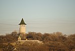
Prospect Park is a historic neighborhood within the University community of the U.S. city of Minneapolis, Minnesota. The area is bounded by the Mississippi River to the south, the City of Saint Paul, Minnesota to the east, the Burlington Northern railroad yard to the north, and the Stadium Village commercial district of the University of Minnesota to the west. The neighborhood is composed of several districts which include the East River Road area. The 1913 Prospect Park Water Tower is a landmark and neighborhood icon. An urban village once served by streetcar, Prospect Park is now a combination of multiple districts and uses. People live in single-family homes on Tower Hill, as well as apartment housing in the western districts. Estate homes of the early to mid 20th century line East River Road. The SouthEast Industrial Area (SEMI) in the north contains light manufacturing, rail yards and remnant grain silos. University Avenue houses a mix of retail and restaurant businesses from the Stadium Village area. The entire 138-acre (56 ha) core of the neighborhood was listed on the National Register of Historic Places in 2015 as the Prospect Park Residential Historic District for its significance in the theme of social history. It was nominated for its cohesive community spirit, developed—despite the neighborhood's hilly terrain and diverse housing stock—through such innovations as Minneapolis's first community association.

University Avenue (Minneapolis–Saint Paul)

University Avenue is a street that runs through both Minneapolis and Saint Paul, Minnesota. It begins near the Minnesota State Capitol in Saint Paul and extends westward into neighboring Minneapolis, where it passes the University of Minnesota, and then turns north to pass through several suburbs before its main portion ends in Blaine, Minnesota, although there are stretches of road designated as University Avenue that are north of the Blaine terminus, the final stretch ending near Andree, Minnesota. For many years, the road carried U.S. Highway 12 and U.S. Highway 52 (at least for part of its length), and University Avenue is still a significant thoroughfare in the area. University Avenue originally ran along a line several blocks north of its current location, forming a route that once connected the Minneapolis campus of the University of Minnesota to Hamline University in Saint Paul (hence the name). When the construction of the Minnesota Transfer Railway yards blocked that route, the street was moved one-half mile to the south on the Saint Paul side, to what was then called Melrose Avenue. The old University Avenue route was renamed Minnehaha Avenue, which it remains to this day.Some important neighborhoods the road passes through include Frogtown (officially, the Thomas-Dale neighborhood) and the Midway region, both in Saint Paul. Hubbard Broadcasting and its flagship stations, KSTP-AM-FM-TV, are on University at the border of Minneapolis and Saint Paul. In fact, the sidewalk at the KSTP studios is right on the city/county line. This was one of the highest points in the area, an appropriate site for a radio transmitter. An antenna structure still stands there today, though it is used for microwave links rather than broadcasting (KSTP and most other Twin Cities stations use the Telefarm installation in Shoreview, Minnesota, or the nearby KMSP Tower). A water tower commonly known as the Witch's Hat stands just a few blocks away in Minneapolis's Prospect Park neighborhood. In 1890, the first interurban streetcar link between Minneapolis and Saint Paul used University Avenue and Washington Avenue in Minneapolis. History is now being repeated, as the METRO Green Line light rail connects the two downtowns as well as the University of Minnesota along a similar route. University Avenue carries Ramsey County Road 34 in Saint Paul, and Hennepin County Road 36 in Minneapolis to the junction with I-35W. West and north of Central Avenue, University Avenue carries Minnesota State Highway 47 to the junction with US 10, after which it carries Anoka County Road 51.