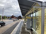
Droylsden
DroylsdenGeography of TamesideTowns in Greater ManchesterUnparished areas in Greater ManchesterUse British English from September 2012

Droylsden is a town in Tameside, Greater Manchester, England, 4.1 miles (6.6 km) east of Manchester city centre and 2.2 miles (3.5 km) west of Ashton-under-Lyne, with a population at the 2011 Census of 22,689.Within the boundaries of the historic county of Lancashire, in the mid-19th century Droylsden grew as a mill town on the Ashton canal. Beginning in the early 1930s, Droylsden's population expanded rapidly as it became a housing overflow area for neighbouring Manchester. Since 1785, the Fairfield area of Droylsden has been home to a Moravian Church.
Excerpt from the Wikipedia article Droylsden (License: CC BY-SA 3.0, Authors, Images).Droylsden
Sunny Bank Road, Tameside Fairfield
Geographical coordinates (GPS) Address Phone number Website Nearby Places Show on map
Geographical coordinates (GPS)
| Latitude | Longitude |
|---|---|
| N 53.4828 ° | E -2.1582 ° |
Address
Droylsden Academy
Sunny Bank Road
M43 6QD Tameside, Fairfield
England, United Kingdom
Open on Google Maps


