place

Ashley Reservoir

1873 establishments in MassachusettsAC with 0 elementsGeography of Holyoke, MassachusettsReservoirs in Massachusetts
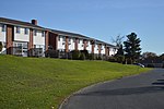
Trails along the shore of Ashley Reservoir, Holyoke, Massachusetts (2010)

Ashley Reservoir, a Class II hazard reservoir, is the secondary drinking supply for the city of Holyoke, Massachusetts. The reservoir, consisting of Wright Pond and Ashley Pond, has an impound capacity of more than 795 million gallons of water and a safe yield of 2.1 million gallons of water per day. The reservoir's construction finished and it became fully operational in 1897. Ashley Reservoir is connected to a smaller reservoir McLean Reservoir, named after Holyoke Water Works Commissioner Hugh McLean, through a water-pumping plant that is operated by the Holyoke Water Works. The reservoir has a surrounding gravel road open to civilian recreational use.

Excerpt from the Wikipedia article Ashley Reservoir (License: CC BY-SA 3.0, Authors, Images).

Ashley Reservoir
Whitney Avenue, Holyoke

Geographical coordinates (GPS) Address Nearby Places
placeShow on map

Wikipedia: Ashley ReservoirContinue reading on Wikipedia

Geographical coordinates (GPS)

Latitude Longitude
N 42.175 ° E -72.661 °
placeShow on map

Address

Whitney Avenue

Whitney Avenue
01703 Holyoke
Massachusetts, United States
mapOpen on Google Maps

Trails along the shore of Ashley Reservoir, Holyoke, Massachusetts (2010)
Share experience

Nearby Places

Holyoke Community College

Holyoke Community College (HCC) is a public community college in Holyoke, Massachusetts. It offers associate degrees and certificate programs, as well as a transfer program for students to earn credits for transfer to other colleges. It was the first community college established in Massachusetts, as it was founded by the city's school board in 1946, while others were subsequently chartered under state jurisdiction after 1960. HCC currently offers more than 100 associate degree and certificate options, as well as adult basic education/GED programs, education and training for business and industry, and noncredit community education classes. In a 2016 report on community colleges in the United States, the Aspen Institute and Columbia University's Community College Research Center cited HCC as among 2-year community colleges with best practices for student transfers to 4 year institutions such as the University of Massachusetts Amherst. Additionally among the 15 community colleges in Massachusetts, HCC has the highest percentage of student graduates completing associate degrees and certificate programs.HCC is located on a 135-acre (0.55 km2) campus, and has satellite locations throughout the Pioneer Valley, including the HCC-MGM Culinary Arts Institute, the only culinary arts program at a Massachusetts college accredited by the American Culinary Federation.The college participates in the Commonwealth Dual Enrollment Partnership (CDEP) and allows high school applicants to opt for full or part-time coursework to receive both high school and transferable college credit. Enrolled students may also complete certain coursework at Mount Holyoke and Smith College, as both share faculty with the community college. Holyoke Community College is accredited by the New England Commission of Higher Education.

Rock Valley, Holyoke, Massachusetts

Rock Valley, sometimes referred to as West Holyoke, is a neighborhood in Holyoke, Massachusetts located to the west of the city center, approximately 3 miles (4.8 km) from downtown, bordering Easthampton, Southampton, Westfield, and West Springfield. Rock Valley is historically Holyoke's second oldest village after Elmwood, with its eponymous burial ground dating to around 1777, and families having settled in the area as early as 1745. Predating the construction of the Hadley Falls Dam, it originated as the western section of the 3rd parish ("Ireland Parish") of West Springfield. Today the neighborhood contains several historic Federal and Colonial homesteads, in addition to many modern developments adjacent to agricultural and wetland tracts.Even into the 20th century the area retained an agrarian character, but was met with concern by residents who believed their neighborhood to be falling behind the progress made by the rest of the city during its sudden industrial growth. In 1921, the West Holyoke Improvement Association was founded by a number of concerned for the purpose of representing the interests of the neighborhood before the city government. Renamed the Rock Valley Improvement League in 1955, among the issues they lobbied for was the electrification of streets lights in the area, construction of a community center, and development of new playgrounds for children. The association would hold many neighborhood dinners and events for a number of years as well, and having achieved many of the aforementioned goals fell into relative obscurity. In 1930 the area briefly gained international attention when a former supply route to Westfield built by soldiers of the 104th Infantry was dedicated in Massachusetts as the Apremont Highway in a joint ceremony between Holyoke and Westfield. The 104th was the first American military unit to receive a foreign decoration for valor and the first foreign recipients of the French Croix de Guerre, for liberating Apremont-la-Forêt in the First World War.