place

Wraysbury and Hythe End Gravel Pits

Sites of Special Scientific Interest in Berkshire
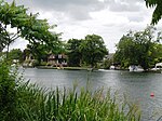
Footpath near Wraysbury geograph.org.uk 156495

Wraysbury and Hythe End Gravel Pits is a 117.2-hectare (290-acre) biological Site of Special Scientific Interest in Wraysbury in Berkshire. It is part of South West London Waterbodies Ramsar site and Special Protection Area.The site features four former gravel pits and is within the floodplains of the River Thames and the Colne Brook. It is important for the number of bird species it features.

Excerpt from the Wikipedia article Wraysbury and Hythe End Gravel Pits (License: CC BY-SA 3.0, Authors, Images).

Wraysbury and Hythe End Gravel Pits
Staines Road,

Geographical coordinates (GPS) Address Nearby Places
placeShow on map

Wikipedia: Wraysbury and Hythe End Gravel PitsContinue reading on Wikipedia

Geographical coordinates (GPS)

Latitude Longitude
N 51.451 ° E -0.545 °
placeShow on map

Address

Staines Road
TW19 5AG
England, United Kingdom
mapOpen on Google Maps

Footpath near Wraysbury geograph.org.uk 156495
Share experience

Nearby Places

Ankerwycke Yew
Ankerwycke Yew

The Ankerwycke Yew is an ancient yew tree close to the ruins of St Mary's Priory, the site of a Benedictine nunnery built in the 12th century, near Wraysbury in Berkshire, England. It is a male tree with a girth of 8 metres (26 ft) at 0.3 metres. The tree is at least 1,400 years old, and could be as old as 2,500 years.On the opposite bank of the River Thames are the meadows of Runnymede and this tree is said to have been witness to the signing of Magna Carta. The tree is also said to be the location where Henry VIII courted Anne Boleyn in the 1530s. Here the confederate Barons met King John, and having forced him to yield to the demands of his subjects they, under the pretext of securing the person of the King from the fury of the multitude, conveyed him to a small island belonging to the nuns of Ankerwyke [the island], where he signed the Magna Carta. There is some justification for the theory that the Ankerwycke Yew could be "the last surviving witness to the sealing of the Magna Carta 800 years ago". "In the 13th century, the landscape would have been different as the area was probably rather marshy as it was within the flood plain of the Thames. The Ankerwycke Yew is on a slightly raised area of land (therefore dry) and with the proximity of the Priory perhaps both lend some credibility to this claim."The Ankerwycke Yew is situated on lands managed by the National Trust. In 2002 it was designated one of fifty Great British Trees by The Tree Council.