place

Snugburys

2010s fires in the United Kingdom2017 disasters in the United Kingdom2017 fires in Europe2017 in EnglandCompanies based in Cheshire
Food and drink companies of EnglandIce cream brandsNantwichSculptures in England
Snugbury's Ice Cream Farm geograph.org.uk 220957

Snugburys is an English ice cream manufacturer based at Park Farm in Hurleston, near Nantwich, in the county of Cheshire. Snugburys makes over 35 flavours of ice cream. In addition to ice cream production, Snugburys also regularly produces large sculptures made of steel-reinforced straw.

Excerpt from the Wikipedia article Snugburys (License: CC BY-SA 3.0, Authors, Images).

Snugburys
Chester Road,

Geographical coordinates (GPS) Address Nearby Places
placeShow on map

Wikipedia: SnugburysContinue reading on Wikipedia

Geographical coordinates (GPS)

Latitude Longitude
N 53.087388888889 ° E -2.5652777777778 °
placeShow on map

Address

Chester Road
CW5 8LN , Stoke and Hurleston
England, United Kingdom
mapOpen on Google Maps

Snugbury's Ice Cream Farm geograph.org.uk 220957
Share experience

Nearby Places

Acton, Cheshire
Acton, Cheshire

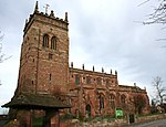
Acton is a small village and former civil parish, now in the parish of Burland and Acton, lying immediately west of the town of Nantwich, in the unitary authority area of Cheshire East and the ceremonial county of Cheshire, England. The civil parish covered 762 acres (3.08 km2) and also included the small settlement of Dorfold and part of Burford, with an estimated population of 340 in 2006. It is administered jointly with the adjacent civil parishes of Henhull and Edleston. Historically, Acton refers to a township and also to an ancient parish in the Nantwich Hundred covering a wide area to the west of Nantwich. The area is agricultural, with dairy farming the main industry. Around a third of the area falls within the Dorfold Estate. Historically, agriculture was the major employer, but it has now been overtaken by the service industries, with many residents commuting significant distances outside the parish to work. The civil parish is believed to have been inhabited since the 8th or 9th century. Acton appears in the Domesday Book of 1086, when it was one of the wealthiest townships in the Nantwich Hundred, being valued for the same sum as Nantwich. The name means "oak town", referring to the pedunculate oaks that predominated in the adjacent Forest of Mondrem. During the Civil War, the village was taken by siege several times. The Shropshire Union Canal reached the parish in 1835, using a long embankment to avoid Dorfold Park. The parish contains many historic buildings, including two listed at grade I: Dorfold Hall was considered by Nikolaus Pevsner to be one of the two finest Jacobean houses in Cheshire, while St Mary's Church has a tower dating from the 13th century, one of the earliest in the county.