Hurleston
Borough of Cheshire EastFormer civil parishes in CheshireVillages in Cheshire

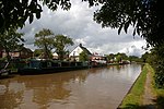
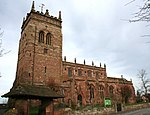
Hurleston was a civil parish until May 2023 and now forms part of the civil parish of Stoke and Hurleston, within the unitary authority area of Cheshire East and the ceremonial county of Cheshire, England, which lies to the north west of Nantwich. The area is predominantly rural with scattered farms and buildings and no settlements. Nearby villages include Barbridge, Burland, Radmore Green, Rease Heath and Stoke Bank. According to the 2001 census, the parish had a population of 64. At the 2011 Census the population remained less than 100. Details are included in the civil parish of Stoke.
Excerpt from the Wikipedia article Hurleston (License: CC BY-SA 3.0, Authors, Images).Hurleston
Chester Road,
Geographical coordinates (GPS) Address Nearby Places Show on map
Geographical coordinates (GPS)
| Latitude | Longitude |
|---|---|
| N 53.091 ° | E -2.567 ° |
Address
Chester Road
Chester Road
CW5 8LN , Stoke and Hurleston
England, United Kingdom
Open on Google Maps


