place

A1079 road

Infobox road instances in the United KingdomInfobox road maps tracking categoryRoads in YorkshireTransport in YorkTransport in the East Riding of Yorkshire
Use British English from February 2013
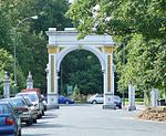
A1079 beverley eastbound enh

The A1079 is a major road in Northern England. It links the cities of York and Kingston upon Hull, both in Yorkshire. The road is noted for its past safety issues, and regularly features in the Road Safety Foundations reports on Britain's most dangerous roads. Campaigners have been calling for the entire route to be made into a dual carriageway.

Excerpt from the Wikipedia article A1079 road (License: CC BY-SA 3.0, Authors, Images).

A1079 road
Beverley Road, Hull Sculcoates

Geographical coordinates (GPS) Address Nearby Places
placeShow on map

Wikipedia: A1079 roadContinue reading on Wikipedia

Geographical coordinates (GPS)

Latitude Longitude
N 53.77063 ° E -0.35448 °
placeShow on map

Address

Beverley Road

Beverley Road
HU6 7LG Hull, Sculcoates
England, United Kingdom
mapOpen on Google Maps

A1079 beverley eastbound enh
Share experience

Nearby Places

Newland, Kingston upon Hull

Newland is a suburb of Kingston upon Hull, East Riding of Yorkshire, England, in the north-west of the city, a former village on the Hull to Beverley turnpike. Before the mid 18th century Newland was a hamlet in a partially swampy agricultural area, located near the crossroads of Cottingham and Beverley-Hull turnpikes. Extensive enclosure and drainage took place after 1766, and it briefly developed as a preferred place for Hull merchants in the 19th century. The future parish church, St John's, was built in 1833, and in 1862 the ecclesiastical parish of Newland was established as separate from Cottingham in the East Riding. By the beginning of the 20th century the urban spread of Hull had reached Newland, and over the next half century the village was surrounded by housing and other developments. The modern area of Newland includes and the former site of the Kingston upon Hull Municipal Training College (est. 1913), later the University of Humberside and now part of the neighbouring Hull University (est. 1925), as well as the Newland Park estate, and the Newland Avenue areas. Other notable structures in the area include the former Endsleigh convent (orig. built 1876, expanded), and former Sailor's Orphan's Homes (1890s), and the modern Humberside Police headquarters (2012). The Newland area extends along Clough Road to the River Hull – east of the Cottingham/ Beverley Road crossroads, where the area is in primarily industrial and commercial use. On the banks of the Hull is a chemical works of the Croda company.