place

Corkerhill Carriage Servicing Maintenance Depot

1896 establishments in ScotlandBuildings and structures completed in 1896Glasgow and South Western RailwayRailway depots in ScotlandScotland rail transport stubs
Use British English from December 2016
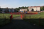
Corkerhill Depot geograph.org.uk 1371085

Corkerhill Carriage Servicing Maintenance Depot is located in Corkerhill, Glasgow, Scotland. The depot is situated on the Paisley Canal Line and is to the east of Corkerhill station. The depot code is CK.

Excerpt from the Wikipedia article Corkerhill Carriage Servicing Maintenance Depot (License: CC BY-SA 3.0, Authors, Images).

Corkerhill Carriage Servicing Maintenance Depot
M77, Glasgow Dumbreck

Geographical coordinates (GPS) Address Nearby Places
placeShow on map

Wikipedia: Corkerhill Carriage Servicing Maintenance DepotContinue reading on Wikipedia

Geographical coordinates (GPS)

Latitude Longitude
N 55.8358 ° E -4.3252 °
placeShow on map

Address

M77
G52 1TW Glasgow, Dumbreck
Scotland, United Kingdom
mapOpen on Google Maps

Corkerhill Depot geograph.org.uk 1371085
Share experience

Nearby Places

Bellahouston Park
Bellahouston Park

Bellahouston Park (Scottish Gaelic: Pàirc Bhaile Ùisdean) is a public park in the Bellahouston district on the South Side of Glasgow, Scotland, between the areas of Craigton, Dumbreck, Ibrox and Mosspark covering an area of 71 hectares (180 acres). The main part of Bellahouston Park was acquired by Glasgow Corporation in 1895 for the sum of £50,000, and opened to the public in 1896. Three years later, the city's second municipal golf course was established at Bellahouston, following the success of the course at Alexandra Park. The park was extended in 1901 by the addition of a part of Dumbreck Lands purchased for £2,824 from Sir John Stirling-Maxwell. A further addition was made in 1903, at a cost of £40,222, by including the lands of Ibroxhill, from which commanding views of the city are available. In 1938 the Empire exhibition was held at the park. The site took fourteen months to build. The price of admission was one shilling, and 12.5 million visits were recorded. The exhibition made a loss of £130,000. Of the 200 palaces and pavilions that were built for the exhibition, only the Palace of Art remains. It now serves as a Sports Excellence Centre. A stone Peace Cairn built for the exhibition is still visible from the rock garden. In 1996 Charles Rennie Mackintosh's House for an Art Lover was completed from original drawings of 1901, and now serves as centre for the visual arts. It is based around Bella hill, created for the great Empire Exhibition. It has commanding views over most of the city, although views to the east are obscured by trees, and those to the south by hills in Mosspark. Views include that of Ballageich (Balagich) hill, rising to 1,084 feet (330 m) on the southern horizon in East Renfrewshire.

Tait Tower
Tait Tower

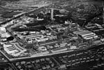
Tait Tower (also known as Tait's Tower and officially as the Tower of Empire) was a tower in the art deco style constructed at the summit of Ibrox Hill in Bellahouston Park in Glasgow in Scotland as part of the Empire Exhibition, Scotland 1938. It was designed by Thomas S. Tait, stood 300 feet (91 metres) high and had three separate observation decks which provided a view of the surrounding gardens and city. Due to both the height of the tower and the hill it was built on, it could be seen 100 miles (160 km) away. The tower was the centrepiece of the Empire Exhibition and its image featured on many of the souvenirs that could be bought at the exhibition site. The Empire Exhibition took place at a time when Glasgow was the centre of British shipbuilding and engineering, and the materials – steel beams riveted together and clad in corrugated steel – were produced by Glasgow manufacturing plants. Tait's design and readily available materials made it possible for the tower to be constructed in only nine weeks.The tower was dismantled in July 1939 after the exhibition closed. The foundations remain at Bellahouston Park. Thomas' son Gordon Tait also worked on the project. In December 2007, the Tait Tower was included in a 3D graphic reconstruction of the Empire Exhibition by the Digital Design Studio at Glasgow School of Art, sourced from contemporary photographs, film footage, sketches and drawings from the archive of the Mitchell Library.

Craigton, Glasgow
Craigton, Glasgow

Craigton (Scottish Gaelic: Baile Chreig) is a residential suburb in the southwest of the city of Glasgow, Scotland. Located approximately three miles (five kilometres) from the city centre, it is bordered by Bellahouston Park to the south and Halfway to the west, with Cardonald beyond.The area was historically farming land for Govan, which is nearby to the north across the M8 motorway and Inverclyde Line railway tracks. A pedestrian underpass, previously a road on which city trams and buses operated, leads north from Craigton under the motorway onto Craigton Road, which is within the Drumoyne neighbourhood. Historically the Craigton Road area was occupied by Craigton Farm, while the estate of Craigton House was acquired to build the Craigton neighbourhood (developed for housing between the World Wars, as were Drumoyne and other nearby developments like the contrasting Moorepark and Mosspark projects). The area has an eponymous primary school opened in 1910 (once attended by artist George Wyllie), a small industrial estate and a number of shops lining Paisley Road West. Craigton Cemetery is immediately to the west of Craigton and was opened in 1873. The cemetery grounds contain a crematorium, which opened in 1957. To the east is Helen Street police station (a modern replacement for Govan's previous offices in Orkney Street) built on the site of the White City Stadium, used for greyhound racing and motorcycle speedway; Ibrox railway station was slightly further east, also within walking distance of Craigton until its closure in the late 1960s, about the same time as the stadium. The triangular parcel of land between Paisley Road West and Mosspark Boulevard and west of Bellahouston Park has been occupied by housing since the 1920s. It was originally fields belonging to a farm called Wearieston so was occasionally known as such in the years following its construction, but the name has since fallen out of use. Since 2017, Craigton has fallen within the Pollokshields ward under Glasgow City Council, having been in the Govan ward for the decade prior. There was also a ward named Craigton, but the neighbourhood of that name was never part of it, and in 2017 it was re-named to the more accurate title of Cardonald.