place

Halfway, Glasgow

Areas of GlasgowGlasgow geography stubsUse British English from May 2015
Halfway 1983
Halfway 1983

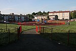
Halfway, also known as Halfwayhouse (Scottish Gaelic: Taigh Letheach Slighe), is a neighbourhood on the south-west side of the city of Glasgow, Scotland. Once a small village in its own right, sitting on the original Renfrewshire-Lanarkshire border, the area takes its name from the fact that it lies equidistant between Glasgow and Paisley at a distance of 3 miles (5 kilometres) from each ('Three Mile House' was situated on Paisley Road West, but has long since gone, although 'Two Mile House' built and owned by the various railway companies at the junction of Dumbreck Road survived into the 1980s). In 1926, Halfwayhouse and a handful of neighbouring villages including Cardonald, Hillington and Crookston were annexed to the ever-expanding city of Glasgow. This resulted in the renaming of many local roads to prevent duplication with ones in Glasgow. Through the 1940s and 1950s, Halfwayhouse was developed significantly to the point where there is very little trace of the original village on what is still the main road between Glasgow and Paisley. The area is bordered by two cemeteries: Craigton Cemetery to the north overlooked by the 1950s Moss Heights multi-storey apartments and Cardonald Cemetery to the south, adjoining the Mosspark neighbourhood.

Excerpt from the Wikipedia article Halfway, Glasgow (License: CC BY-SA 3.0, Authors, Images).

Halfway, Glasgow
Tarfside Gardens, Glasgow Craigton

Geographical coordinates (GPS) Address Phone number Website Nearby Places
placeShow on map

Wikipedia: Halfway, GlasgowContinue reading on Wikipedia

Geographical coordinates (GPS)

Latitude Longitude
N 55.845247 ° E -4.333383 °
placeShow on map

Address

Our Lady Of The Rosary Primary School & Nursery Class

Tarfside Gardens 50
G52 3AA Glasgow, Craigton
Scotland, United Kingdom
mapOpen on Google Maps

Phone number

call+441418832010

Website
ourladyoftherosary-pri.glasgow.sch.uk

linkVisit website

Halfway 1983
Halfway 1983
Share experience

Nearby Places

Craigton, Glasgow
Craigton, Glasgow

Craigton (Scottish Gaelic: Baile Chreig) is a residential suburb in the southwest of the city of Glasgow, Scotland. Located approximately three miles (five kilometres) from the city centre, it is bordered by Bellahouston Park to the south and Halfway to the west, with Cardonald beyond.The area was historically farming land for Govan, which is nearby to the north across the M8 motorway and Inverclyde Line railway tracks. A pedestrian underpass, previously a road on which city trams and buses operated, leads north from Craigton under the motorway onto Craigton Road, which is within the Drumoyne neighbourhood. Historically the Craigton Road area was occupied by Craigton Farm, while the estate of Craigton House was acquired to build the Craigton neighbourhood (developed for housing between the World Wars, as were Drumoyne and other nearby developments like the contrasting Moorepark and Mosspark projects). The area has an eponymous primary school opened in 1910 (once attended by artist George Wyllie), a small industrial estate and a number of shops lining Paisley Road West. Craigton Cemetery is immediately to the west of Craigton and was opened in 1873. The cemetery grounds contain a crematorium, which opened in 1957. To the east is Helen Street police station (a modern replacement for Govan's previous offices in Orkney Street) built on the site of the White City Stadium, used for greyhound racing and motorcycle speedway; Ibrox railway station was slightly further east, also within walking distance of Craigton until its closure in the late 1960s, about the same time as the stadium. The triangular parcel of land between Paisley Road West and Mosspark Boulevard and west of Bellahouston Park has been occupied by housing since the 1920s. It was originally fields belonging to a farm called Wearieston so was occasionally known as such in the years following its construction, but the name has since fallen out of use. Since 2017, Craigton has fallen within the Pollokshields ward under Glasgow City Council, having been in the Govan ward for the decade prior. There was also a ward named Craigton, but the neighbourhood of that name was never part of it, and in 2017 it was re-named to the more accurate title of Cardonald.