place

Bellahouston Park Halt railway station

1938 establishments in Scotland1939 disestablishments in ScotlandDisused railway stations in GlasgowFormer London, Midland and Scottish Railway stationsGlasgow railway station stubs
Pages with no open date in Infobox stationRailway stations in Great Britain closed in 1939Railway stations in Great Britain opened in 1938Use British English from February 2021

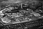
Bellahouston Park Halt railway station served the district of Bellahouston, Glasgow, Scotland, from 1938 to 1939 on the Paisley Canal line.

Excerpt from the Wikipedia article Bellahouston Park Halt railway station (License: CC BY-SA 3.0, Authors).

Bellahouston Park Halt railway station
Paisley Road West, Glasgow Bellahouston

Geographical coordinates (GPS) Address Nearby Places
placeShow on map

Wikipedia: Bellahouston Park Halt railway stationContinue reading on Wikipedia

Geographical coordinates (GPS)

Latitude Longitude
N 55.8455 ° E -4.3183 °
placeShow on map

Address

Sunken Garden

Paisley Road West
G52 1EQ Glasgow, Bellahouston
Scotland, United Kingdom
mapOpen on Google Maps

Share experience

Nearby Places

Tait Tower
Tait Tower

Tait Tower (also known as Tait's Tower and officially as the Tower of Empire) was a tower in the art deco style constructed at the summit of Ibrox Hill in Bellahouston Park in Glasgow in Scotland as part of the Empire Exhibition, Scotland 1938. It was designed by Thomas S. Tait, stood 300 feet (91 metres) high and had three separate observation decks which provided a view of the surrounding gardens and city. Due to both the height of the tower and the hill it was built on, it could be seen 100 miles (160 km) away. The tower was the centrepiece of the Empire Exhibition and its image featured on many of the souvenirs that could be bought at the exhibition site. The Empire Exhibition took place at a time when Glasgow was the centre of British shipbuilding and engineering, and the materials – steel beams riveted together and clad in corrugated steel – were produced by Glasgow manufacturing plants. Tait's design and readily available materials made it possible for the tower to be constructed in only nine weeks.The tower was dismantled in July 1939 after the exhibition closed. The foundations remain at Bellahouston Park. Thomas' son Gordon Tait also worked on the project. In December 2007, the Tait Tower was included in a 3D graphic reconstruction of the Empire Exhibition by the Digital Design Studio at Glasgow School of Art, sourced from contemporary photographs, film footage, sketches and drawings from the archive of the Mitchell Library.

Bellahouston Park
Bellahouston Park

Bellahouston Park (Scottish Gaelic: Pàirc Bhaile Ùisdean) is a public park in the Bellahouston district on the South Side of Glasgow, Scotland, between the areas of Craigton, Dumbreck, Ibrox and Mosspark covering an area of 71 hectares (180 acres). The main part of Bellahouston Park was acquired by Glasgow Corporation in 1895 for the sum of £50,000, and opened to the public in 1896. Three years later, the city's second municipal golf course was established at Bellahouston, following the success of the course at Alexandra Park. The park was extended in 1901 by the addition of a part of Dumbreck Lands purchased for £2,824 from Sir John Stirling-Maxwell. A further addition was made in 1903, at a cost of £40,222, by including the lands of Ibroxhill, from which commanding views of the city are available. In 1938 the Empire exhibition was held at the park. The site took fourteen months to build. The price of admission was one shilling, and 12.5 million visits were recorded. The exhibition made a loss of £130,000. Of the 200 palaces and pavilions that were built for the exhibition, only the Palace of Art remains. It now serves as a Sports Excellence Centre. A stone Peace Cairn built for the exhibition is still visible from the rock garden. In 1996 Charles Rennie Mackintosh's House for an Art Lover was completed from original drawings of 1901, and now serves as centre for the visual arts. It is based around Bella hill, created for the great Empire Exhibition. It has commanding views over most of the city, although views to the east are obscured by trees, and those to the south by hills in Mosspark. Views include that of Ballageich (Balagich) hill, rising to 1,084 feet (330 m) on the southern horizon in East Renfrewshire.

1902 Ibrox disaster
1902 Ibrox disaster

The 1902 Ibrox disaster was the collapse of a stand at Ibrox Park (now Ibrox Stadium) in Govan (now part of Glasgow), Scotland. The incident led to the deaths of 25 supporters and injuries to 500 more during an international association football match between Scotland and England on 5 April 1902 as part of the 1901–02 British Home Championship. Ibrox Park had completed construction less than three years before the incident and was hosting its first international fixture, with the crowd estimated to be over 68,000. The match was the first time that the ground had been used at more than half capacity since its opening. Scotland entered the game needing only to avoid defeat to win the British Home Championship title. During the first half of the match, a section of the newly built West Tribune Stand collapsed, dropping between 200 and 300 people to the concrete floor below. Two spectators were declared dead at the scene, and a further twenty-three died of injuries sustained in the incident soon after, the last victim dying three weeks later. Despite the collapse, the match was eventually resumed after a break as officials feared emptying crowds could interfere with rescue attempts and lead to further panic. The teams resumed the match, which ended in a 1–1 draw, although both the Scottish Football Association and the Football Association later agreed that the result should be voided. A replay was hastily organised and played a month later at Villa Park in Birmingham with all proceeds from the match being donated to a relief fund for victims of the disaster. The disaster led to an overhaul in stadium design, with wooden terraced stands being largely replaced by earth or concrete embankments.