place

Bell Canyon, California

Census-designated places in CaliforniaCensus-designated places in Ventura County, CaliforniaGated communities in CaliforniaPages with non-numeric formatnum argumentsPopulated places established in 1969
Simi HillsUse mdy dates from July 2023
Ventura County California Incorporated and Unincorporated areas Bell Canyon Highlighted 0604938

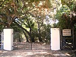
Bell Canyon is an unincorporated community in eastern Ventura County, California, United States. Bell Canyon is a gated community in the Simi Hills with the main access through the Los Angeles community of West Hills and the western San Fernando Valley. Bell Canyon sits at an elevation of 1,368 feet (417 m). The 2020 census reported Bell Canyon's population was 1,946. For statistical purposes, the Census Bureau has defined Bell Canyon as a census-designated place (CDP). According to a 2016 study, Bell Canyon is the seventh wealthiest community in the state of California with an annual median income of $230,000.

Excerpt from the Wikipedia article Bell Canyon, California (License: CC BY-SA 3.0, Authors, Images).

Bell Canyon, California
Stagecoach Road,

Geographical coordinates (GPS) Address Nearby Places
placeShow on map

Wikipedia: Bell Canyon, CaliforniaContinue reading on Wikipedia

Geographical coordinates (GPS)

Latitude Longitude
N 34.208055555556 ° E -118.6875 °
placeShow on map

Address

Stagecoach Road 44
91307
California, United States
mapOpen on Google Maps

Ventura County California Incorporated and Unincorporated areas Bell Canyon Highlighted 0604938
Share experience

Nearby Places

Santa Susana Field Laboratory

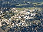
The Santa Susana Field Laboratory (SSFL), formerly known as Rocketdyne, is a complex of industrial research and development facilities located on a 2,668-acre (1,080 ha) portion of Southern California in an unincorporated area of Ventura County in the Simi Hills between Simi Valley and Los Angeles. The site is located approximately 18 miles (29 km) northwest of Hollywood and approximately 30 miles (48 km) northwest of Downtown Los Angeles. Sage Ranch Park is adjacent on part of the northern boundary and the community of Bell Canyon is along the entire southern boundary.SSFL was used mainly for the development and testing of liquid-propellant rocket engines for the United States space program from 1949 to 2006, nuclear reactors from 1953 to 1980 and the operation of a U.S. government-sponsored liquid metals research center from 1966 to 1998. Throughout the years, about ten low-power nuclear reactors operated at SSFL, (including the Sodium Reactor Experiment, the first reactor in the United States to generate electrical power for a commercial grid, and the first commercial power plant in the world to experience a partial core meltdown) in addition to several "critical facilities" that helped develop nuclear science and applications. At least four of the ten nuclear reactors had accidents during their operation. The reactors located on the grounds of SSFL were considered experimental, and therefore had no containment structures. The site ceased research and development operations in 2006. The years of rocket testing, nuclear reactor testing, and liquid metal research have left the site "significantly contaminated". Environmental cleanup is ongoing. The public who live near the site have strongly urged a thorough cleanup of the site, citing cases of long term illnesses, including cancer cases at rates they claim are higher than normal. On 30 March 2018, a seven-year-old girl living in Simi Valley died of neuroblastoma, prompting public urging to thoroughly clean up the site. Experts have said, however, that there is insufficient evidence to identify an explicit link between cancer rates and radioactive contamination in the area.

Atomics International

Atomics International was a division of the North American Aviation company (later acquired by the Rockwell International company) which engaged principally in the early development of nuclear technology and nuclear reactors for both commercial and government applications. Atomics International was responsible for a number of accomplishments relating to nuclear energy: design, construction and operation of the first nuclear reactor in California (1952), the first nuclear reactor to produce power for a commercial power grid in the United States (1957) and the first nuclear reactor launched into outer space by the United States (1965).Atomics International undertook the development of nuclear reactors soon after being established: a series of commercial nuclear power reactors beginning with the Sodium Reactor Experiment (SRE) and a range of compact nuclear reactors culminating with the Systems for Auxiliary Nuclear Power SNAP-10A system. Both efforts were successful, despite nuclear accidents at the Santa Susana Field Laboratory, but overall interest in nuclear power steadily declined. The division transitioned to non-nuclear energy-related projects such as coal gasification and gradually ceased designing and testing nuclear reactors. Atomics International was eventually merged with another division (Rocketdyne division) of the same parent company (Rockwell International). As of 2010, all of the Atomics International facilities, except for the few remaining facilities located in the Area IV test area at the Santa Susana Field Laboratory (SSFL), have been demolished, cleaned and reused, or awaiting final cleanup.

Sage Ranch Park
Sage Ranch Park

Sage Ranch Park is a 625-acre park (253 ha) and wildlife corridor located at a 2,000 feet (610 m) height in the northwestern Simi Hills on the northwestern plateau of the Simi Valley, bordering Los Angeles County and its San Fernando Valley. The campground area used to be a cattle ranch and later a filmset for Western movies. Sage Ranch Park is today an intermountain wildlife corridor, which links the Simi Hills with the Santa Susana- and Santa Monica Mountains. The mountainous park is mostly known for its unique sandstone rock formations, maybe particularly on its western side where the Sandstone Ridge and Turtle Rock are situated. On its northern side, there are great panoramic rural and metropolitan views of the Simi Valley, as well as surrounding Simi Hills, Santa Susana Mountains and beyond. It is home to numerous sandstone formations, caves, outcroppings, tilted rock formations, several hiking trails, a camping ground, as well as native flora and wildlife. The area is lined with coastal sage scrub and other flora includes chaparral, bush lupine, California poppy, sunflowers, Cream Cups, bracken, sword fern, prickly pear cactus, eucalyptus trees, oak woodland of ceanothus, coffee berry, California buckwheat, sycamore, Walnut Tree, ferns, orange- and avocado trees. It is a critical cross-mountain wildlife corridor and is home to fauna such as mountain lions, bobcats, eagles, vultures, owls, rattle snakes, coyotes, hawks, grey fox, king snakes, and more. Bordering Sage Ranch to the south is the Rocketdyne Santa Susana Field Laboratory, in which the nearby Burro Flats Painted Cave is located. It is an area for a wide variety of recreational activities such as running, mountain biking, hiking, wildlife viewing, photographing, rock climbing, and is also open for camping. Because of its high elevation, you can see as far as the Channel Islands, the Santa Monica Mountains, the Pacific Ocean, and the San Gabriel Mountains on clear days. To get here from Woodland Hills, Los Angeles, follow the Ventura Freeway (U.S. 101) in Woodland Hills, exit on Valley Circle Boulevard and drive north six miles to Woolsey Canyon Road. Turn left (west) and proceed 2.7 miles to Sage Ranch Park. The park entrance is on the left, a short distance past the Rockwell International Santa Susana Field Laboratory, where Woolsey Canyon Road bends north and continues as Black Canyon Road. From Chatsworth, Los Angeles, take the 118 to Topanga Canyon Boulevard, south to Plummer, and then turn right. Follow Plummer to the intersection with Box Canyon and turn left into Valley Circle and then turn right at Woolsey Canyon Road. The entrance to Sage Ranch Park is 200 yards north of the intersection between Woolsey Canyon and Black Canyon Road. From Simi Valley, take Kuehner south and turn right at Katherine Road in eastern Simi Valley. Follow Katherine and turn right after crossing the railroad tracks. At Black Canyon Road, turn left and follow the uphill winding road up to Sage Ranch Park. It is situated in the most eastern part of Ventura County and the Simi Valley city limits. The address is 1 Black Canyon Rd, Simi Valley, CA 93065.