place

Hilgenried Bay

Bays of Lower SaxonyBays of the North SeaGeography of East FrisiaHistory of East Frisia
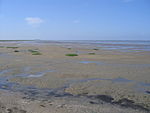
Ehemalige Hilgenrieder Bucht vom Blandorfer Geestrand

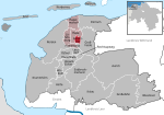
Hilgenried Bay (German: Hilgenrieder Bucht) is a bay on the German North Sea coast near Hilgenriedersiel, a village in the municipality of Hagermarsch in the Lower Saxon county of Aurich. It was probably formed during the Dunkirk transgression as a result of the washing out of the mouth of one or more small streams, but has now largely silted up. In the 9th century, the village of Nesse emerged as a trading settlement and important port. The region around Hilgenried bay was probably the scene of the so-called Battle of Norditi, in 884, a Frisian army under the command of Archbishop Rimbert of Bremen-Hamburg defeated the Danish Vikings, precipitating the complete withdrawal of Vikings from East Frisia. The bay only needed to be relatively lightly dyked during the High Middle Ages because the local streams only had a very small catchment and did not hinder the reclamation of land greatly. Nesse was cut off from the sea no later than the 13th century and around 1300 the enclosing line of dykes was completed.

Excerpt from the Wikipedia article Hilgenried Bay (License: CC BY-SA 3.0, Authors, Images).

Hilgenried Bay
Sielstraße,

Geographical coordinates (GPS) Address Nearby Places
placeShow on map

Wikipedia: Hilgenried BayContinue reading on Wikipedia

Geographical coordinates (GPS)

Latitude Longitude
N 53.65926 ° E 7.366762 °
placeShow on map

Address

Sielstraße 19
26553
Lower Saxony, Germany
mapOpen on Google Maps

Ehemalige Hilgenrieder Bucht vom Blandorfer Geestrand
Share experience

Nearby Places

East Frisian Islands

The East Frisian Islands (German: Ostfriesische Inseln, West Frisian: Eastfryske eilannen, Saterland Frisian: Aastefräiske Ailounds) are a chain of islands in the North Sea, off the coast of East Frisia in Lower Saxony, Germany. The islands extend for some 90 kilometres (56 mi) from west to east between the mouths of the Ems and Jade / Weser rivers and lie about 3.5 to 10 km offshore. Between the islands and the mainland are extensive mudflats, known locally as Watten, which form part of the Wadden Sea. In front of the islands are Germany's territorial waters, which occupy a much larger area than the islands themselves. The islands, the surrounding mudflats and the territorial waters (The Küstenmeer vor den ostfriesischen Inseln nature reserve) form a close ecological relationship. The island group makes up about 5% of the Lower Saxony Wadden Sea National Park. The largest island by surface area is Borkum, located at the western end of the chain; the other six inhabited islands are from west to east: Juist, Norderney with the largest town in the islands, Baltrum, Langeoog, Spiekeroog and Wangerooge. There are also four other small, uninhabited islands: Lütje Hörn east of Borkum, Memmert and Kachelotplate southwest of Juist, Minsener Oog, a dredged island southeast of Wangerooge, and Mellum at the eastern end of the island chain which, following the boundary revision by the Federal Office for Nature Conservation, no longer belongs to the East Frisian Islands, but to the mudflats of the Elbe-Weser Triangle (Watten im Elbe-Weser-Dreieck).