place

Neßmersiel

Seaside resorts in GermanyTowns and villages in East FrisiaTowns in Lower Saxony
DEU Nessmersiel COA
DEU Nessmersiel COA

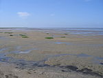
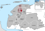
Neßmersiel belongs to the municipality Dornum in the rural district Aurich in Lower Saxony, Germany. Neßmersiel is located about 5 kilometres northwest of Dornum. From 1867 to 1977, Neßmersiel belonged to Norden (Altkreis Norden). The original port was built about 1570. Grain was shipped to Bremen, Hamburg, the Netherlands and Norway. By 1700, the harbour had to be moved closer to the sea when the original location filled with silt from the dikes. By 1930, the new location was also closed. The ferry to Baltrum was built in 1969/1970. Most coastal tours of the north German sea coast begin here at Neßmersiel. Each year 10 - 12 million migratory birds visit nearby Wattenmeer National Park of Lower Saxony (Nationalpark Niedersächsisches Wattenmeer). The resort village of Neßmersiel lies directly behind the dike and contains mostly holiday homes. There are also restaurants, hotels, cafes, and numerous shops. A playground for children is at the beach. The "Sturmfrei" is new since March 2007. The complex includes a 3D-cinema, wellness center, restaurant, Show- and Sportcourt and a big kidsarea. The "Sturmfrei" is the biggest Funcenter at the German Northseacoast Near Nessmersiel a Bavarian sex comedy was filmed in 1973 ("The East Frisian Report"). You can still find some locations from the movie.

Excerpt from the Wikipedia article Neßmersiel (License: CC BY-SA 3.0, Authors, Images).

Neßmersiel
Störtebekerstraße,

Geographical coordinates (GPS) Address Nearby Places
placeShow on map

Wikipedia: NeßmersielContinue reading on Wikipedia

Geographical coordinates (GPS)

Latitude Longitude
N 53.666666666667 ° E 7.35 °
placeShow on map

Address

Störtebekerstraße
26553 , Neßmersiel
Lower Saxony, Germany
mapOpen on Google Maps

DEU Nessmersiel COA
DEU Nessmersiel COA
Share experience

Nearby Places

East Frisian Islands

The East Frisian Islands (German: Ostfriesische Inseln, West Frisian: Eastfryske eilannen, Saterland Frisian: Aastefräiske Ailounds) are a chain of islands in the North Sea, off the coast of East Frisia in Lower Saxony, Germany. The islands extend for some 90 kilometres (56 mi) from west to east between the mouths of the Ems and Jade / Weser rivers and lie about 3.5 to 10 km offshore. Between the islands and the mainland are extensive mudflats, known locally as Watten, which form part of the Wadden Sea. In front of the islands are Germany's territorial waters, which occupy a much larger area than the islands themselves. The islands, the surrounding mudflats and the territorial waters (The Küstenmeer vor den ostfriesischen Inseln nature reserve) form a close ecological relationship. The island group makes up about 5% of the Lower Saxony Wadden Sea National Park. The largest island by surface area is Borkum, located at the western end of the chain; the other six inhabited islands are from west to east: Juist, Norderney with the largest town in the islands, Baltrum, Langeoog, Spiekeroog and Wangerooge. There are also four other small, uninhabited islands: Lütje Hörn east of Borkum, Memmert and Kachelotplate southwest of Juist, Minsener Oog, a dredged island southeast of Wangerooge, and Mellum at the eastern end of the island chain which, following the boundary revision by the Federal Office for Nature Conservation, no longer belongs to the East Frisian Islands, but to the mudflats of the Elbe-Weser Triangle (Watten im Elbe-Weser-Dreieck).