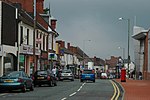
Cradley, West Midlands

Cradley () is a village in the Black Country and Metropolitan Borough of Dudley near Halesowen and the banks of the River Stour. Colley Gate is the name of the short road in the centre of Cradley. It was part of the ancient parish of Halesowen, but unlike much of the rest of that parish, which was an exclave of Shropshire, Cradley was always in Worcestershire, until the creation of the West Midlands county in 1974. This meant that for civil administrative purposes, Cradley formerly had the officers which a parish would have had. The population of the appropriate Dudley Ward (Cradley and Wollescote) taken at the 2011 census was 13,340.There are two villages named Cradley in the Midlands of England although the names are pronounced differently; the "other" Cradley lies about 30 miles to the southwest, near to the Malvern Hills in south Worcestershire, but just across the county boundary in Herefordshire. In the 19th century a new settlement grew up in heathland on the other side of the river and became known as Cradley Heath. This was in the ancient parish of Rowley Regis. Previously the residents of Cradley had the right to graze their animals on that heath, subject to a small annual payment to the lord of the manor.
Excerpt from the Wikipedia article Cradley, West Midlands (License: CC BY-SA 3.0, Authors, Images).Cradley, West Midlands
Mapletree Lane,
Geographical coordinates (GPS) Address Nearby Places Show on map
Geographical coordinates (GPS)
| Latitude | Longitude |
|---|---|
| N 52.46 ° | E -2.086 ° |
Address
Maple Tree Lane / Colley Gate
Mapletree Lane
B63 2BT
England, United Kingdom
Open on Google Maps


